Select Item below to DOWNLOAD - Once item is selected, right click and choose 'save as'
3a75d516-462b-4d6b-bb54-07f907265985
Aerial View
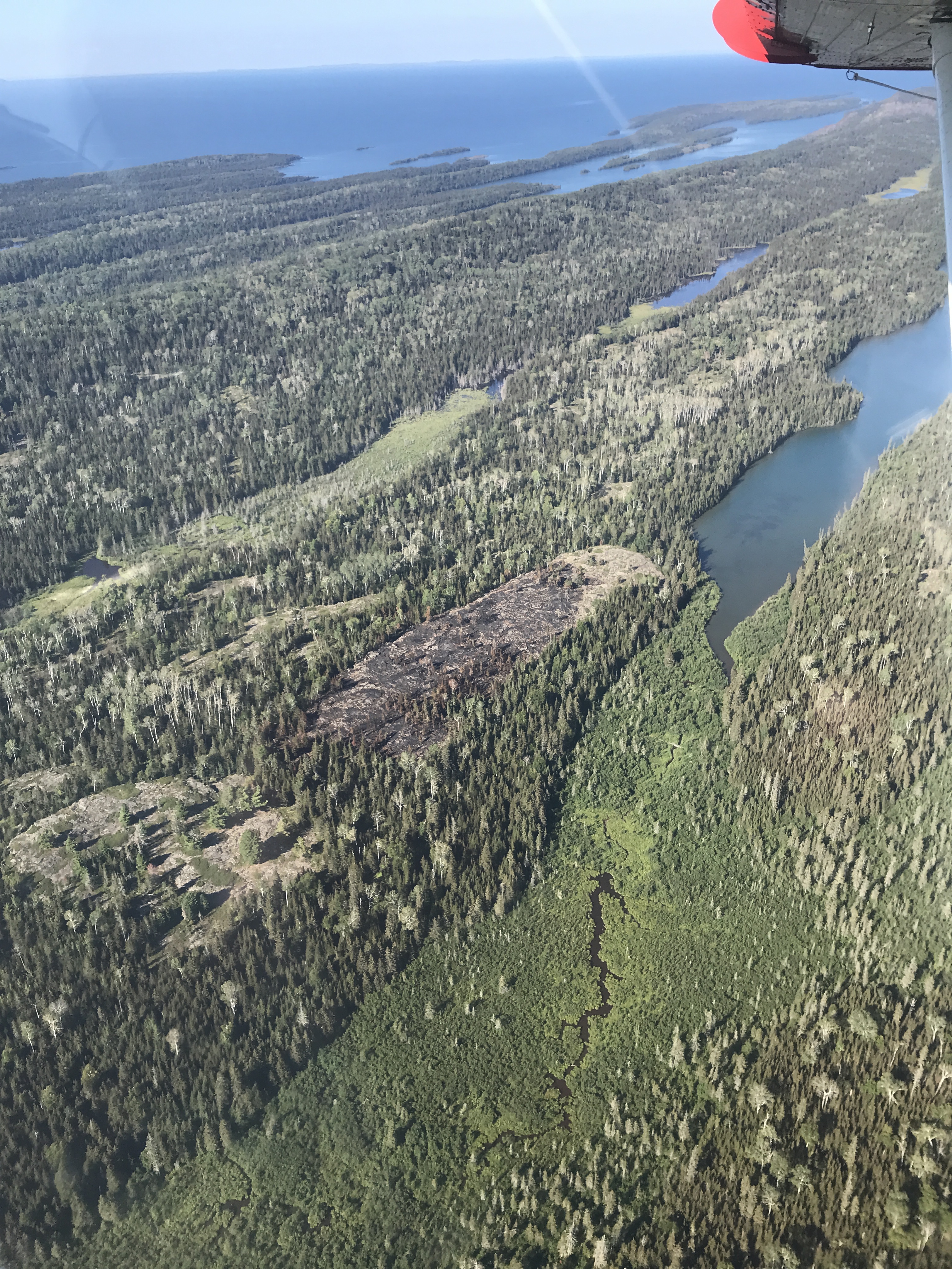
An aerial view shows a small burned area in a forest surrounded by Lake Superior.
An aerial view of the Mount Franklin Fire burn area from a seaplane.
Permission must be secured from the individual copyright owners to reproduce any copyrighted materials contained within this website. Digital assets without any copyright restrictions are public domain.
NPS Photo
Public domain:Full Granting Rights
Image
Isle Royale National Park, Code: ISRO
Isle Royale National Park, Keweenaw County, Michigan
Latitude: 48.0108985900879, Longitude: -88.828498840332
Latitude: 48.0108985900879, Longitude: -88.828498840332
08/21/2022
08/21/2022
Public Can View
Tuesday, August 30, 2022 7:27:24 PM
Tuesday, August 30, 2022 7:31:33 PM
Mt Franklin Fire Aerial 1.JPG
Apple Apple, iPhone 7 20, iPhone 7 back camera 3.99mm f/1.8
1/1244 sec at f / 1.8
3.99 mm
ISO 20
Sunday, August 21, 2022 5:23:17 PM
jpg
4.4 MB
Scenic