Select Item below to DOWNLOAD - Once item is selected, right click and choose 'save as'
2f4017c3-d5be-4b31-bb45-313837d9a65a
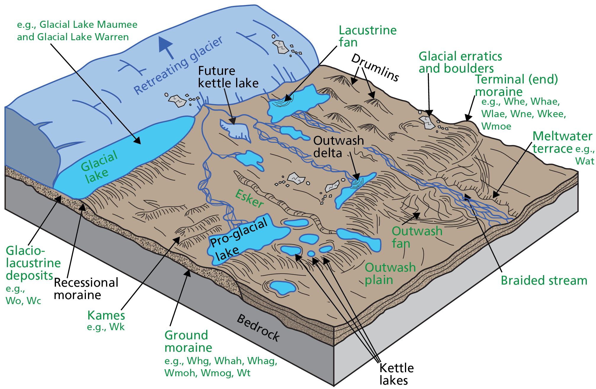
Schematic Illustration of Glacial Features and Deposits.
Schematic illustration of glacial features and deposits. The caption lists the glacial features depicted on the illustration that occur within the park, along with the associated geologic map unit(s).
Glacial features that occur within Cuyahoga Valley National Park are labeled in green and include the following: glacial lakes (e.g., Glacial Lakes Maumee and Warren), glaciolacustrine deposits (e.g., map units Wo and Wc), lacustrine fans, glacial erratics and boulders, terminal (end) moraines (e.g., map units Whe, Whae, Wlae, Wne, Wkee, and Wmoe), ground moraines (e.g., map units Whg, Whah, Whag, Wmoh, Wmog, and Wt), meltwater terraces (e.g., map unit Wat), braided streams, outwash fans, outwash plains, eskers, and kames (e.g., map unit Wk).
Permission must be secured from the individual copyright owners to reproduce any copyrighted materials contained within this website. Digital assets without any copyright restrictions are public domain.
Graphic by Trista L. Thornberry-Ehrlich (Colorado State University).
Public domain:Full Granting Rights
Image
Cuyahoga Valley National Park, Code: CUVA
Cuyahoga Valley National Park, Ohio
Latitude: 41.1502799987793, Longitude: -81.5678787231445
Latitude: 41.1502799987793, Longitude: -81.5678787231445
01/01/0001
Public Can View
Tuesday, May 18, 2021 3:37:59 PM
Tuesday, May 18, 2021 3:37:59 PM
CUVA_11_Glacial_features_0710-2019_tte-01.jpg
Monday, January 1, 0001 12:00:00 AM
jpg
1.4 MB
Scenic