Select Item below to DOWNLOAD - Once item is selected, right click and choose 'save as'
2b5229cdde214e84abc8e9f412617042
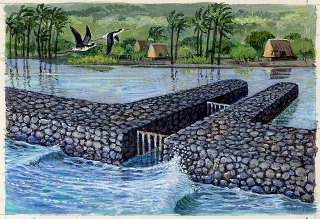
Spot illustration depicts fish traps with fish ponds - walled-in areas along the shore where fish are raised.
Spot illustration depicts fish traps with fish ponds - walled-in areas along the shore where fish are raised.
Shown is the kuapā (wall) and mākāhā (sluice gate). Fishponds belonged to the aliʻi (chief), who distributed fish when needed to feed the common people or the court.
Spot illustration is grouped on single support with IMS # 10792 (raised planters), IMS # 10793 (birds), and IMS # 10794 (timber harvest). This illustration was published reversed in the park brochure. Value upon completion includes $4,100.00 under P1160030052 for modifications to the original illustration brought about by the Na Hoa Pili Kaloko-Honokōhau Advisory Commission.; Abbr=PUB
U.S. National Park Service
Project=Folder; Art_Registration_No=PUB-0143 ; Reflective Art
Government owns art and all reproduction rights.
Public domain
Image
Kaloko-Honokohau National Historical Park, Code: KAHO
Kaloko-Honokohau National Historical Park, Hawaii County, Hawaii
Latitude: 19.6807994842529, Longitude: -156.031005859375
Latitude: 19.6807994842529, Longitude: -156.031005859375
Image Management System : IMS 10791
20190904
01/01/2004 - 12/30/2004
Image_Size=18-3/4" x 9"; Count:2/5; Kaloko-Honokohau National Historical Park brochure
MC G2
Public Can View
Organization: Harpers Ferry Center
Address: Harpers Ferry Center, 67 Mather Place, Harpers Ferry, WV, 25425, 304-535-5050
Address: Harpers Ferry Center, 67 Mather Place, Harpers Ferry, WV, 25425, 304-535-5050
Wednesday, October 9, 2019 11:27:57 AM
Wednesday, October 9, 2019 11:27:57 AM
10791.jpg
jpg
96.1 kB
Museum