Select Item below to DOWNLOAD - Once item is selected, right click and choose 'save as'
26f5bbea-7934-48d1-8f63-851041e1c5a7
ALPO.2001.DN.2009
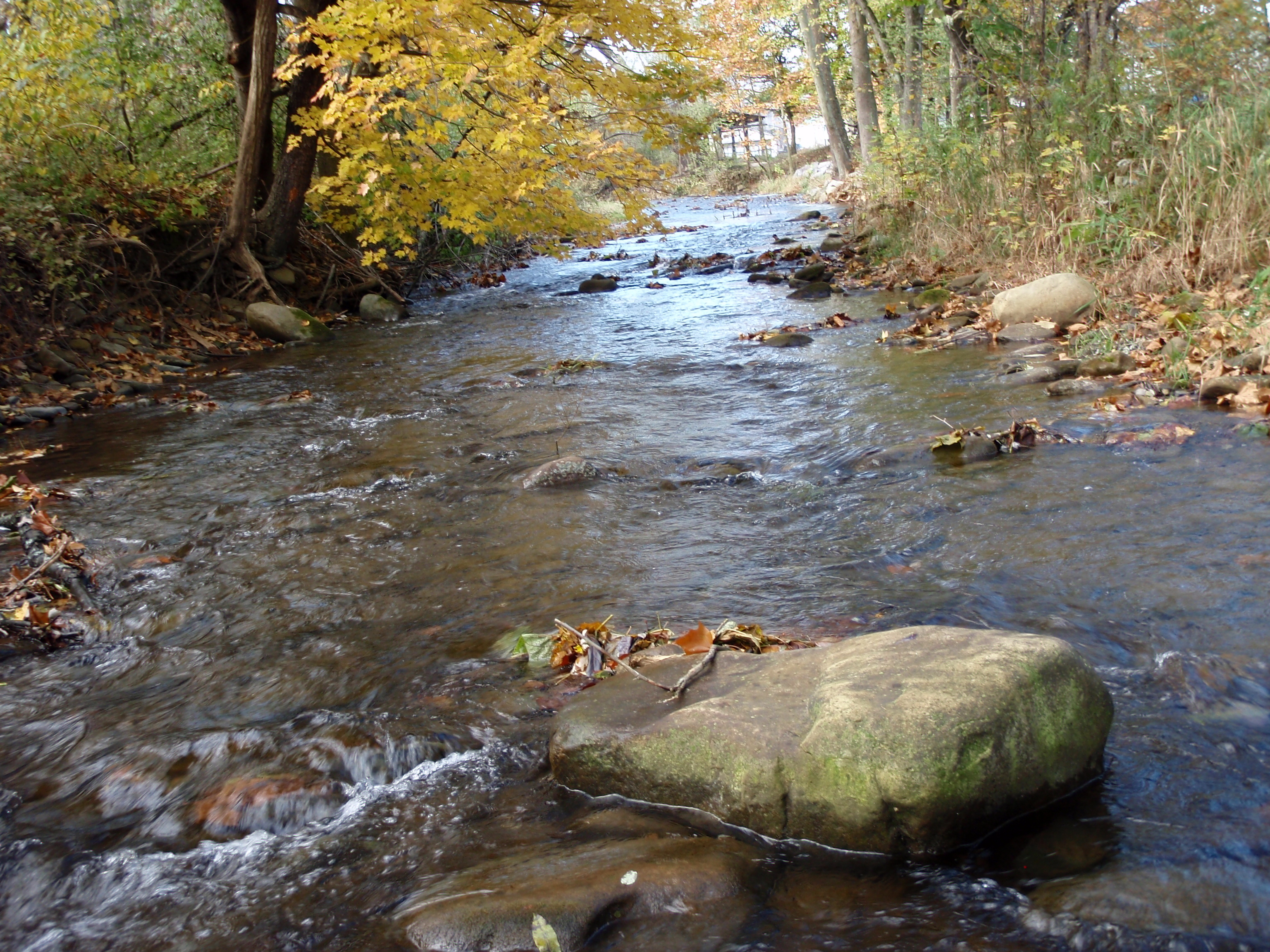
Site visit photo showing the upstream (UP) or downstream (DN) view of a wadeable stream reach taken during benthic macroinvertebrate monitoring at Allegheny Portage Railroad National Historic Site.
Site visit photo showing the upstream (UP) or downstream (DN) view of a wadeable stream reach taken during benthic macroinvertebrate monitoring at Allegheny Portage Railroad National Historic Site.
U.S. National Park Service
This digital asset is in the public domain. When using this asset for any purpose, including online, use: Photo Credit: U.S. National Park Service.
Photo Credit: National Park Service
Public domain
Blair Gap Run - ALPO.2001, (ERMN Stream Site Name)
, ALPO.2001, (ERMN Stream Site ID)
, ALPO.2001.DN, (ERMN Stream Site Up and Down)
, ERMN Benthic Macroinvertebrate Monitoring, (ERMN Project Name)
, ALPO.2001, (ERMN Stream Site ID)
, ALPO.2001.DN, (ERMN Stream Site Up and Down)
, ERMN Benthic Macroinvertebrate Monitoring, (ERMN Project Name)
Image
Allegheny Portage Railroad National Historic Site, Code: ALPO
Eastern Rivers and Mountains Network, Code: ERMN
Eastern Rivers and Mountains Network, Code: ERMN
Allegheny Portage Railroad National Historic Site, Pennsylvania
Latitude: 40.4554786682129, Longitude: -78.5469284057617
Latitude: 40.4554786682129, Longitude: -78.5469284057617
Title: NPS DataStore Project
URL: https://irma.nps.gov/DataStore/Reference/Profile/2229360
Title: Eastern Rivers and Mountains Network Website
URL: https://www.nps.gov/im/ermn/index.htm
URL: https://irma.nps.gov/DataStore/Reference/Profile/2229360
Title: Eastern Rivers and Mountains Network Website
URL: https://www.nps.gov/im/ermn/index.htm
2009/10/21
01/01/2009 - 12/30/2009
Public Can View
Organization: Eastern Rivers and Mountains Network
Position: Data Manager
Position: Data Manager
Friday, August 9, 2024 3:35:41 PM
Friday, August 9, 2024 3:35:41 PM
ALPO.2001.DN.2009.JPG
jpg
3.2 MB
Monitoring