Select Item below to DOWNLOAD - Once item is selected, right click and choose 'save as'
26024992-abb4-4e72-8e59-269a415db397
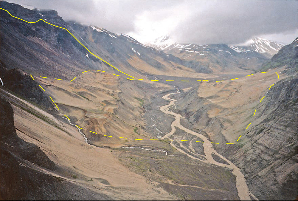
Katmai Canyon Landslide
Photograph showing the Katmai Canyon landslide.
Photograph showing the Katmai Canyon
landslide. The hummocky area on both sides of the Katmai
River is the landslide deposit, marked by a dashed line,
with the crest of the scarp shown with a solid black line.
The landslide dammed the river, creating a temporary lake
that flooded in 1915. Subsequently, the river has cut down
through the landslide deposit.
Permission must be secured from the individual copyright owners to reproduce any copyrighted materials contained within this website. Digital assets without any copyright restrictions are public domain.
USGS-CalVO photograph by
Wes Hildreth.
Public domain:Full Granting Rights
Image
Alagnak Wild River, Code: ALAG
Katmai National Park and Preserve, Code: KATM
Katmai National Park and Preserve, Code: KATM
Alagnak Wild River, Lake and Peninsula Borough, Alaska
Latitude: 59.003101348877, Longitude: -156.082000732422
Katmai National Park and Preserve, Alaska
Latitude: 58.5661087036133, Longitude: -154.889404296875
Latitude: 59.003101348877, Longitude: -156.082000732422
Katmai National Park and Preserve, Alaska
Latitude: 58.5661087036133, Longitude: -154.889404296875
01/01/0001
Public Can View
Friday, September 3, 2021 12:04:21 PM
Friday, September 3, 2021 1:01:57 PM
16_KATM_Fig_Katmai Canyon Landslide Hildreth x Fierstein 2012 Fig 123 -01.jpg
Monday, January 1, 0001 12:00:00 AM
jpg
1.8 MB
Scenic