Select Item below to DOWNLOAD - Once item is selected, right click and choose 'save as'
242c8e41-4793-4b3c-9ce9-9ef8201245b9
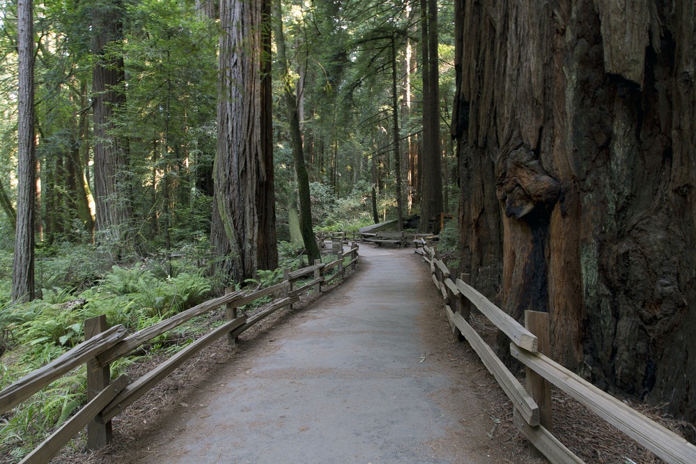
Muir Woods Trail
Photograph of trail among redwood trees at Muir Woods.
Photograph of trail among redwood trees at
Muir Woods. Shaking from earthquakes can cause tree
limbs to break and fall to the ground.
Permission must be secured from the individual copyright owners to reproduce any copyrighted materials contained within this website. Digital assets without any copyright restrictions are public domain.
Photograph from
the Jon B. Lovelace Collection of California Photographs
in Carol M. Highsmith’s America Project, Library of
Congress, Prints and Photographs Division
Public domain:Full Granting Rights
Image
Fort Point National Historic Site, Code: FOPO
Golden Gate National Recreation Area, Code: GOGA
Muir Woods National Monument, Code: MUWO
Golden Gate National Recreation Area, Code: GOGA
Muir Woods National Monument, Code: MUWO
Fort Point National Historic Site, San Francisco County, California
Latitude: 37.8084983825684, Longitude: -122.473999023438
Golden Gate National Recreation Area, California
Latitude: 37.8916893005371, Longitude: -122.635803222656
Muir Woods National Monument, Marin County, California
Latitude: 37.8983993530273, Longitude: -122.583999633789
Latitude: 37.8084983825684, Longitude: -122.473999023438
Golden Gate National Recreation Area, California
Latitude: 37.8916893005371, Longitude: -122.635803222656
Muir Woods National Monument, Marin County, California
Latitude: 37.8983993530273, Longitude: -122.583999633789
07/01/2016
07/01/2016
Public Can View
Photographer: Carol M. Highsmith
Monday, September 6, 2021 9:35:43 AM
Monday, September 6, 2021 10:39:09 AM
40_MUWO_trees2_Carol_Highsmith_LOC_image_cropped.jpg
Canon Canon, Canon EOS 5D Mark III
Friday, July 1, 2016 7:53:08 PM
jpg
3.2 MB
Scenic