Select Item below to DOWNLOAD - Once item is selected, right click and choose 'save as'
21249823-1f2b-4f70-a2be-2b9edd05947b
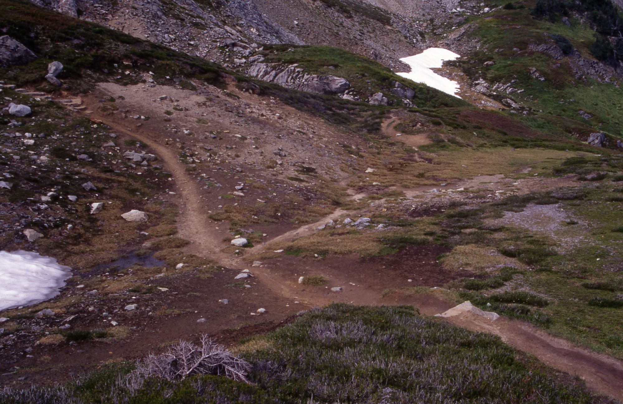
Cascade Pass 1993 Nill map features, 9/11/1996, 68 of 77
A large nearly bald patch of a meadow at the base of a rocky hill with an intersection of two trails at the bottom. In the distance are rocky mountain slopes with a snow melt at the bottom.
Cascade Pass, Sahale Arm, revegetation monitoring photograph. Text on slide frame reads: "REV/CAS/SAH/m-1, Cascade Pass 1993 Nill map features, TR23 at 300 degrees magnetic north, BS, 9/11/96." (North Cascades NPS Complex Museum Collection, NOCA.0013 Revegetation Program Records, Series XI: Photographs, File 001 - Cascade Pass Vicinity Impacts and Revegetation Sites, 1970-2004)
U.S. National Park Service
This digital asset is in the public domain. When using this asset for any purpose, including online, credit: 'Courtesy of North Cascades NPS Complex Museum Collection, Revegetation Program Records.'
NPS Photo
Public domain
Native Plant Restoration, (North Cascades Program)
, Cascade Pass, (North Cascades Locality)
, Revegetation, (North Cascades Activity)
, Cascade Pass, (North Cascades Locality)
, Revegetation, (North Cascades Activity)
Image
North Cascades National Park, Code: NOCA
North Cascades National Park, Washington
Latitude: 48.8278884887695, Longitude: -121.35050201416
Cascade Pass
Latitude: 48.8278884887695, Longitude: -121.35050201416
Cascade Pass
ICMS Archives Module : NOCA.0013.11.001
2024/02/26
09/11/1996
slide transparency
Curation Facility
Public Can View
Person: NOCA Curator
Organization: North Cascades NPS Complex
Position: Museum Curator
Address: 7280 Ranger Station Road, Marblemount, WA 98267
Email: NOCA_Curator@nps.gov.
Organization: North Cascades NPS Complex
Position: Museum Curator
Address: 7280 Ranger Station Road, Marblemount, WA 98267
Email: NOCA_Curator@nps.gov.
Thursday, January 30, 2025 3:53:46 PM
Thursday, January 30, 2025 3:53:46 PM
0013.11.001.1040.tif
tif
36.9 MB
Monitoring