Select Item below to DOWNLOAD - Once item is selected, right click and choose 'save as'
1c6f8007bcf24b4694d49bf0371e0293
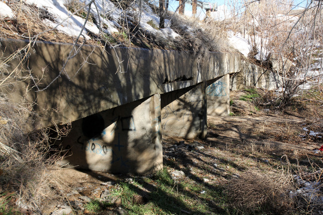
Lost bridge at Carnuel paralleling I-40 on its north side (former 1st paved 2-lane; now 4-lane).
Lost bridge at Carnuel paralleling I-40 on its north side (former 1st paved 2-lane; now 4-lane).
Concrete Culvert or possibly a short slab or beam bridge; GONE; replaced with a Concrete Culvert in the post-66 era for this alignment
U.S. National Park Service
IN COPYRIGHT. This Item is protected by copyright and/or related rights. Copyright: Ross, Jim
Jim Ross
Restrictions apply on use and/or reproduction:Copyrighted material
Image
Route 66 Corridor Preservation Program, Code: ROSI
Bernalillo County, New Mexico
Latitude: 35.064436, Longitude: -106.448484
Latitude: 35.064436, Longitude: -106.448484
20131126
Public Can View
Organization: National Trails, US National Park Service
Address: Route 66 Corridor Preservation Program, PO Box 728 Santa Fe, NM 87505, Phone: (505) 988-6701
Email: IM_RT66@nps.gov
Address: Route 66 Corridor Preservation Program, PO Box 728 Santa Fe, NM 87505, Phone: (505) 988-6701
Email: IM_RT66@nps.gov
Thursday, May 28, 2020 9:01:20 AM
Thursday, May 28, 2020 9:01:20 AM
26-IMG_7748.JPG
jpg
3.7 MB
Inventory