Select Item below to DOWNLOAD - Once item is selected, right click and choose 'save as'
1b33a8a9-1c32-4d4f-a017-9b6d24b072e8
Map
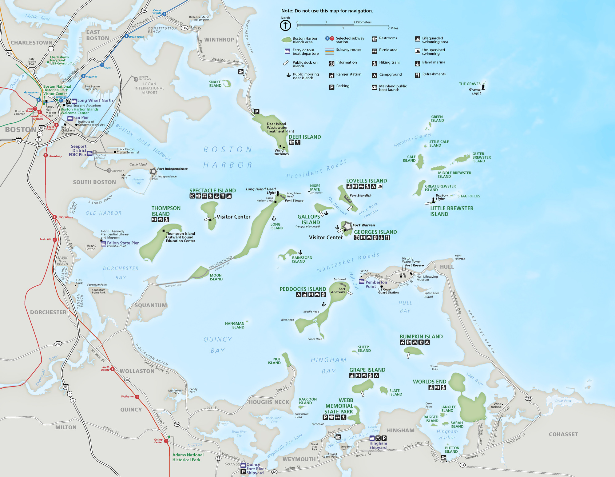
Map of Boston Harbor Islands National Recreation Area.
Map of Boston Harbor Islands National Recreation Area.
Permission must be secured from the individual copyright owners to reproduce any copyrighted materials contained within this website. Digital assets without any copyright restrictions are public domain.
National Park Service map
Public domain:Full Granting Rights
Image
Boston Harbor Islands National Recreation Area, Code: BOHA
Boston Harbor Islands National Recreation Area, Massachusetts
Latitude: 42.2621994018555, Longitude: -70.8761825561523
Latitude: 42.2621994018555, Longitude: -70.8761825561523
01/01/0001
Public Can View
Monday, August 16, 2021 4:23:45 PM
Monday, August 16, 2021 5:17:18 PM
01_BOHAmap1.jpg
Monday, January 1, 0001 12:00:00 AM
jpg
2.8 MB
Scenic