Select Item below to DOWNLOAD - Once item is selected, right click and choose 'save as'
19c62b83-d7a8-47e7-a7af-d0a67a176f9f
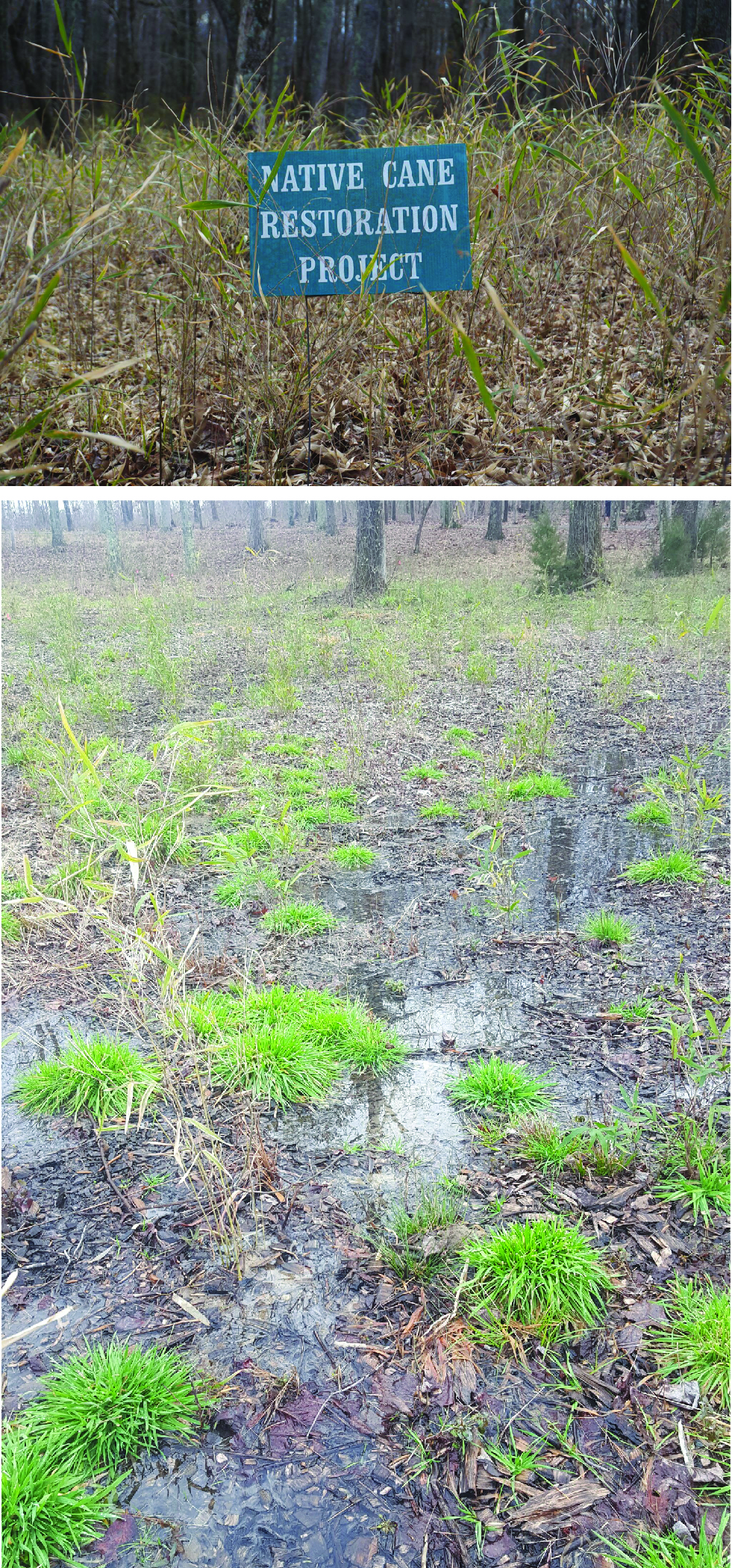
Cane Restoration and Wetlands at the Battlefield.
Figure 16. Photographs showing the cane restoration and wetlands at the battlefield. The top image shows a native cane restoration project area where cane has been replanted to mimic battle-era conditions. The bottom image shows a boggy area of ground with some cane and grasses growing and leafy debris from surrounding trees. Caption follows.
Figure 16. Photographs showing the cane
restoration and wetlands at the battlefield.
Top image shows an active restoration area. Bottom image shows cane growing in a low-lying boggy area. Boggy areas at the time of battle slowed troop movement and made cannons impossible. The Green River Road followed higher ground through the boggy lands. Cane breaks were a prominent feature in the boggy swales of the Cowpens at the time of the battle. The National
Park Service is attempting to restore this native plant and further the battlefield era appearance.
Permission must be secured from the individual copyright owners to reproduce any copyrighted materials contained within this website. Digital assets without any copyright restrictions are public domain.
All images are National Park Service photographs.
Public domain:Full Granting Rights
Image
Cowpens National Battlefield, Code: COWP
Cowpens National Battlefield, Cherokee County, South Carolina
Latitude: 35.1315002441406, Longitude: -81.8093032836914
Latitude: 35.1315002441406, Longitude: -81.8093032836914
01/01/0001
Public Can View
Wednesday, May 12, 2021 10:32:36 AM
Wednesday, May 12, 2021 10:32:36 AM
COWP_16.jpg
Monday, January 1, 0001 12:00:00 AM
jpg
7.1 MB
Scenic