Select Item below to DOWNLOAD - Once item is selected, right click and choose 'save as'
156d7fac-ceb8-4524-940c-2496edb0ce5d
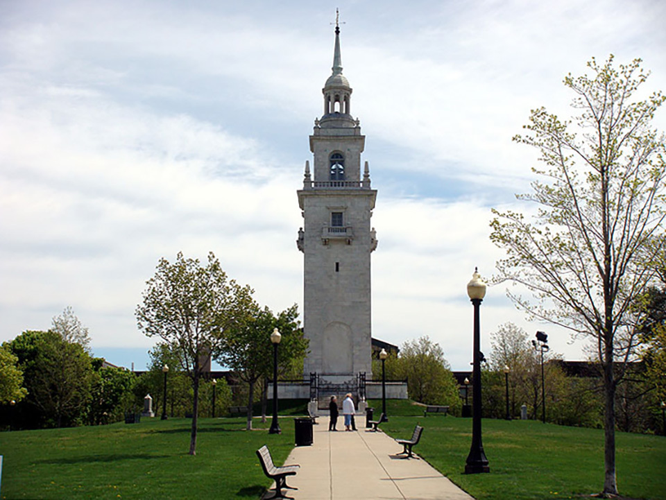
Dorchester Heights Monument
View of Dorchester Monument with a sidewalk leading up to it with grass on either side of the sidewalk.
Constructed in 1901, the Dorchester Heights commemorative tower commemorates the fortification of Dorchester Heights during the Revolutionary War, leading to the British evacuation of the city.
This photograph was taken for the Cultural Landscapes Inventory, Boston National Historical Park and Olmstead Center for Landscape, 2010.
Credit: Olmstead Center for Landscape, 2010.
Public domain
Image
Boston National Historical Park, Code: BOST
Boston National Historical Park, Suffolk County, Massachusetts
Latitude: 42.3734016418457, Longitude: -71.0557022094727
Latitude: 42.3734016418457, Longitude: -71.0557022094727
2010
01/01/0001
Public Can View
Organization: Boston National Historical Park
Thursday, March 10, 2022 7:53:27 AM
Thursday, March 10, 2022 8:25:39 AM
CLI-OCLP2010-27-edited-updated.jpg
Monday, January 1, 0001 12:00:00 AM
jpg
245.0 kB
Scenic