Select Item below to DOWNLOAD - Once item is selected, right click and choose 'save as'
10ed688f-c109-4008-bfdd-0e3b1f7baa02
SEQU_210422_AC_#002_Board Camp Grove.jpg
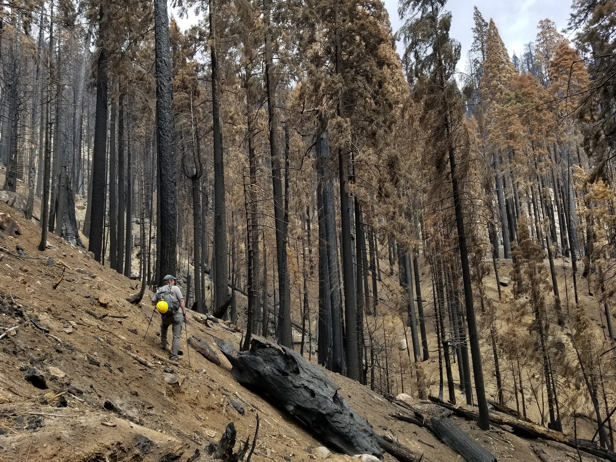
A ranger stands on a hill of dirt in front of scorched black and brown trees.
This April 2021 photo of the Board Camp Grove in Sequoia National Park shows that many sequoias were killed during the Castle Fire.
Permission must be secured from the individual copyright owners to reproduce any copyrighted materials contained within this website. Digital assets without any copyright restrictions are public domain.
NPS / Anthony Caprio
Public domain:Full Granting Rights
Image
Sequoia and Kings Canyon National Parks, Code: SEKI
Latitude: 36.3687438055556, Longitude: -118.716360944444, Elevation: 1950.143
Sequoia and Kings Canyon National Parks, California
Latitude: 36.7172584533691, Longitude: -118.537902832031
Sequoia and Kings Canyon National Parks, California
Latitude: 36.7172584533691, Longitude: -118.537902832031
04/22/2021
04/22/2021
Public Can View
Thursday, June 17, 2021 10:54:05 AM
Thursday, June 17, 2021 10:54:05 AM
Board Camp Grove_20210422_143857_Caprio.jpg
samsung samsung, SM-G892A
1/760 sec at f / 1.7
4.25 mm
ISO 50
Thursday, April 22, 2021 8:38:56 PM
jpg
8.3 MB
Scenic