Select Item below to DOWNLOAD - Once item is selected, right click and choose 'save as'
0d4002bb-8ca1-4d5f-ba87-91dfd5a281d5
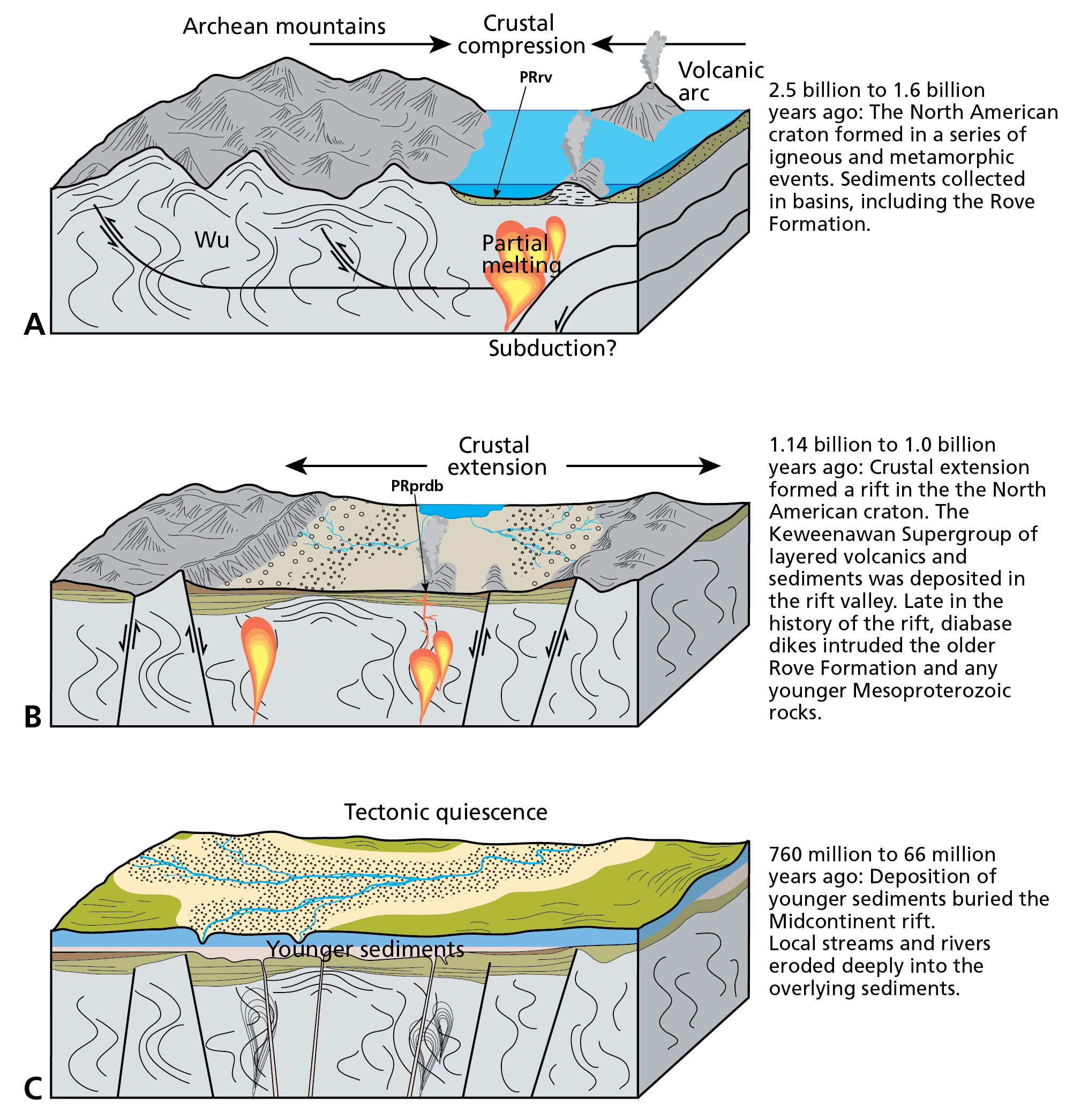
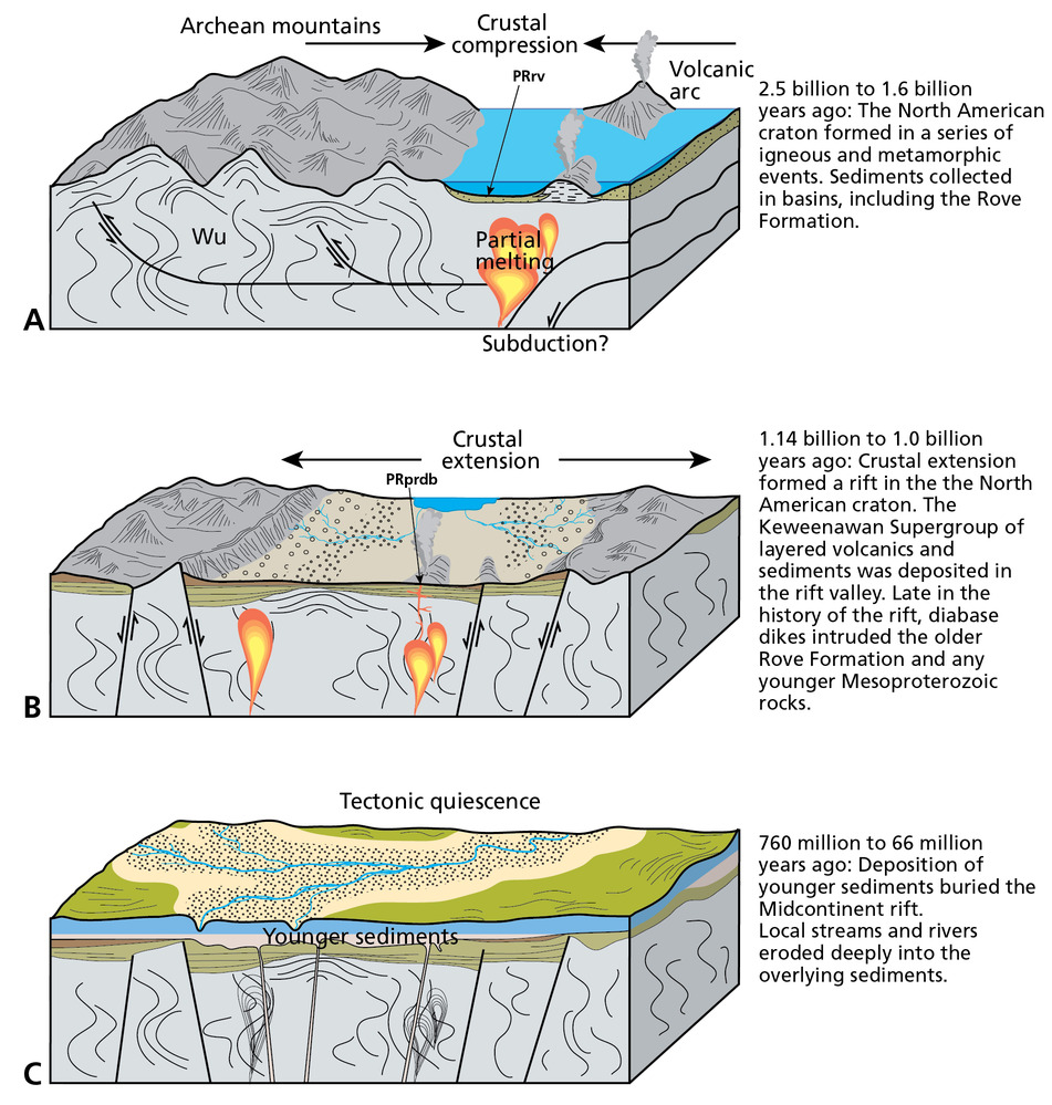
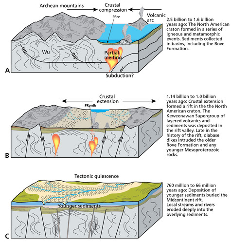
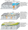
Evolution of the Grand Portage National Monument Landscape.
Block diagram schematic illustration of the evolution of the Grand Portage landscape. Block A shows an ancient subduction zone dipping beneath Archean mountains with map unit PRrv being deposited in the back arc basin. Block B shows crustal extension of the basin and rifting with volcanic and sedimentary material being deposited in the rift basin. Block C shows streams and rivers eroding into the deposited sediments during a time of tectonic quiescence.
Schematic graphics illustrating the evolution of the Grand Portage National Monument
landscape. Not to scale.
Permission must be secured from the individual copyright owners to reproduce any copyrighted materials contained within this website. Digital assets without any copyright restrictions are public domain.
Graphics by Trista L. Thornberry-Ehrlich (Colorado State University).
Public domain:Full Granting Rights
Image
Grand Portage National Monument, Code: GRPO
Grand Portage National Monument, Cook County, Minnesota
Latitude: 47.999698638916, Longitude: -89.7606964111328
Latitude: 47.999698638916, Longitude: -89.7606964111328
01/01/0001
Public Can View
Tuesday, July 6, 2021 5:58:30 PM
Tuesday, July 6, 2021 5:58:30 PM
Figure_4_ac_geologic_evolution-01.jpg
Monday, January 1, 0001 12:00:00 AM
jpg
1.4 MB
Scenic