Select Item below to DOWNLOAD - Once item is selected, right click and choose 'save as'
0624e2b78f1f4b6eb2fa724e2934f499
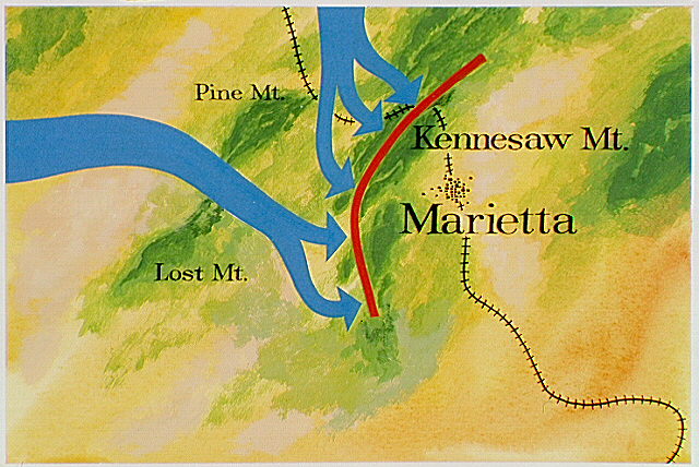
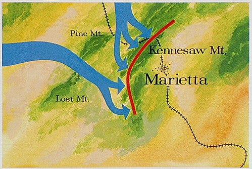
Map showing Major General James B. McPherson, commander of the Army of the Tennessee; Major General George H. Thomas, commander of the Army of the Cumberland; and Major General John M. Schofield, commander of the Army of the Ohio
Map showing Major General James B. McPherson, commander of the Army of the Tennessee; Major General George H. Thomas, commander of the Army of the Cumberland; and Major General John M. Schofield, commander of the Army of the Ohio
(blue arrows) movements of Confederate troops to Kennesaw Mountain.
Abbr=AVA
U.S. National Park Service
Reflective Art
Government owns art and all reproduction rights.
Public domain
Image
Kennesaw Mountain National Battlefield Park, Code: KEMO
Kennesaw Mountain National Battlefield Park, Cobb County, Georgia
Latitude: 33.9772987365723, Longitude: -84.5789031982422
Latitude: 33.9772987365723, Longitude: -84.5789031982422
Image Management System : IMS 01720
20190904
01/01/1977 - 12/30/1977
Image_Size=W: 12" x H: 8"; Metric_Size=W: 30.46CM X H: 20.30CM; AVA Project #38, Plate 25
C11
Public Can View
Organization: Harpers Ferry Center
Address: Harpers Ferry Center, 67 Mather Place, Harpers Ferry, WV, 25425, 304-535-5050
Address: Harpers Ferry Center, 67 Mather Place, Harpers Ferry, WV, 25425, 304-535-5050
Monday, October 7, 2019 3:04:22 PM
Monday, October 7, 2019 3:04:22 PM
01720.JPG
jpg
87.9 kB
Museum