Select Item below to DOWNLOAD - Once item is selected, right click and choose 'save as'
0610dfad4e7f4a6db66dab958259d2e5
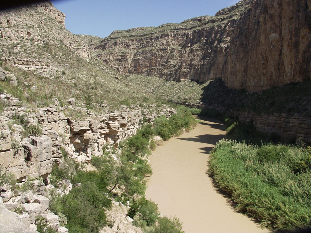
Huisache. River Mile 729.6. September 2009.
Photo of the Rio Grande
Rio Grande vegetation monitoring, "Huisache" photopoint at river mile 729.6, September 2007.
U.S. National Park Service
Huisache is on a rubbly alluvial cone on the Mexican side. The photo point is on a limestone ledge above camp. To access the ledge walk upstream at the base of the ledge and look for a ramp up, then turn back towards camp. This trail will switch back downstream quickly. Once on top follow one of several game trails downstream to a point on a ledge above the camp.
Permission must be secured from the individual copyright owners to reproduce any copyrighted materials contained within this website. Digital assets without any copyright restrictions are public domain.
NPS Photo
Public domain:This photo was taken by staff at Big Bend National Park and is part of the public domain.
Image
Big Bend National Park, Code: BIBE
Rio Grande Wild and Scenic River, Code: RIGR
Rio Grande Wild and Scenic River, Code: RIGR
Latitude: 3296774.6882, Longitude: 743375.9913
Big Bend National Park, Brewster County, Texas
Latitude: 29.3278388977051, Longitude: -103.205894470215
Rio Grande Wild and Scenic River, Texas
Big Bend National Park, Brewster County, Texas
Latitude: 29.3278388977051, Longitude: -103.205894470215
Rio Grande Wild and Scenic River, Texas
20070918
09/18/2007
Public Can View
Person: Resource Management
Organization: US National Park Service
Address: Big Bend National Park, P.O. Box 129, TX 79834-0129
Organization: US National Park Service
Address: Big Bend National Park, P.O. Box 129, TX 79834-0129
Monday, April 20, 2020 8:09:55 AM
Monday, April 20, 2020 8:09:55 AM
RIGR_RioGrande_RioGrandeVegMonitoring_729.6HuisacheR_20070918_6.TIF
tif
16.0 MB
Scenic
,
Monitoring