Select Item below to DOWNLOAD - Once item is selected, right click and choose 'save as'
05a685bb-a6dd-4474-b1bb-67bec3a1c2d7
OZAR CA-18 1966 OZAR 00002120 gif
OZAR CA-18 1966 OZAR 00002120 gif
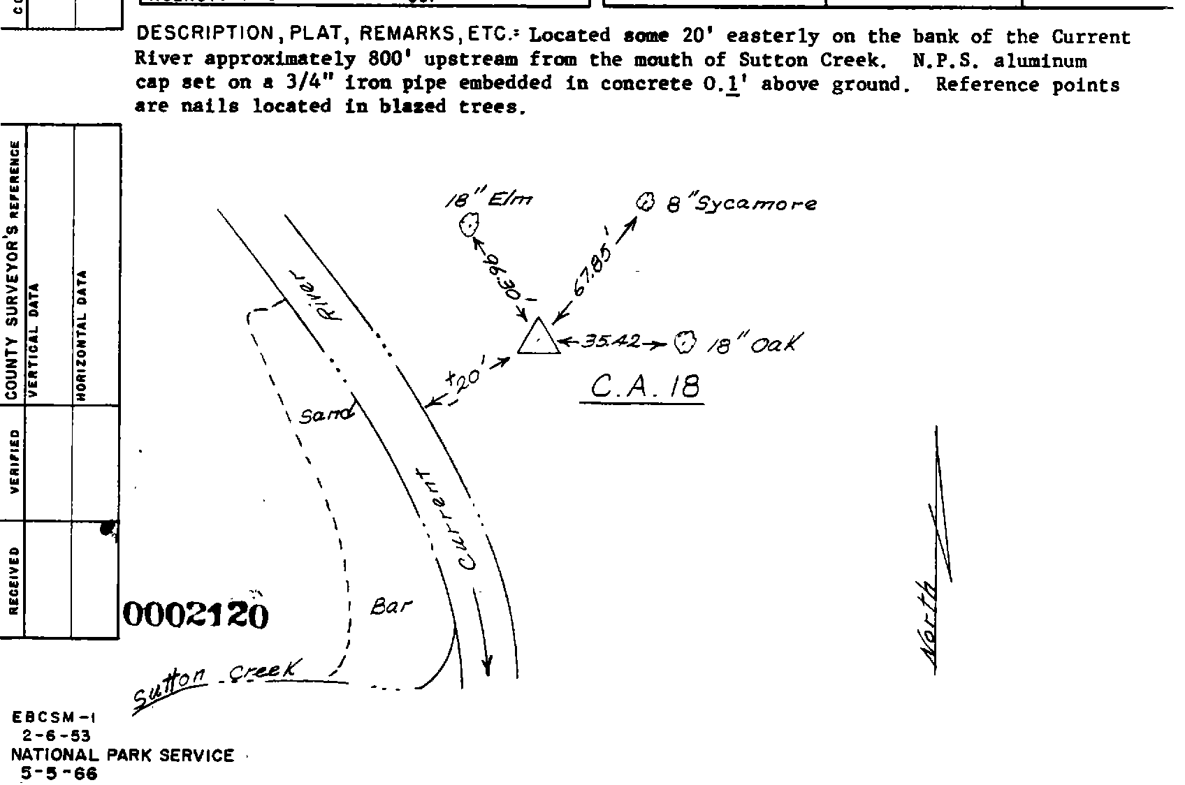
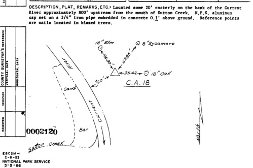
Survey monument record sheet, Sketch number: 00002120
U. S. National Park Service
This digital asset is in the public domain. When using this asset for any purpose, including online, credit: 'U.S. National Park Service, Land Resources Division'.
Public domain
Image
Ozark National Scenic Riverways, Code: OZAR
Ozark National Scenic Riverways, Missouri
Latitude: 37.2426986694336, Longitude: -91.3555526733398
Latitude: 37.2426986694336, Longitude: -91.3555526733398
MONUMENTID for Monuments : OZAR CA-18 1966
2024/11/15
01/01/1966
TOWILL
Public Can View
Organization: Land Resources Division
Position: Program Coordinator
Address: 1849 C Street, NW, Suite 2340, Main Interior Building, Washington, DC 20240
Position: Program Coordinator
Address: 1849 C Street, NW, Suite 2340, Main Interior Building, Washington, DC 20240
Thursday, December 5, 2024 5:53:53 PM
Thursday, December 5, 2024 5:53:53 PM
OZAR_00002120.gif
gif
29.3 kB
Monitoring
,
Inventory
,
Map