Select Item below to DOWNLOAD - Once item is selected, right click and choose 'save as'
fff0b9a5-f200-44b5-a303-c80b2d76462e
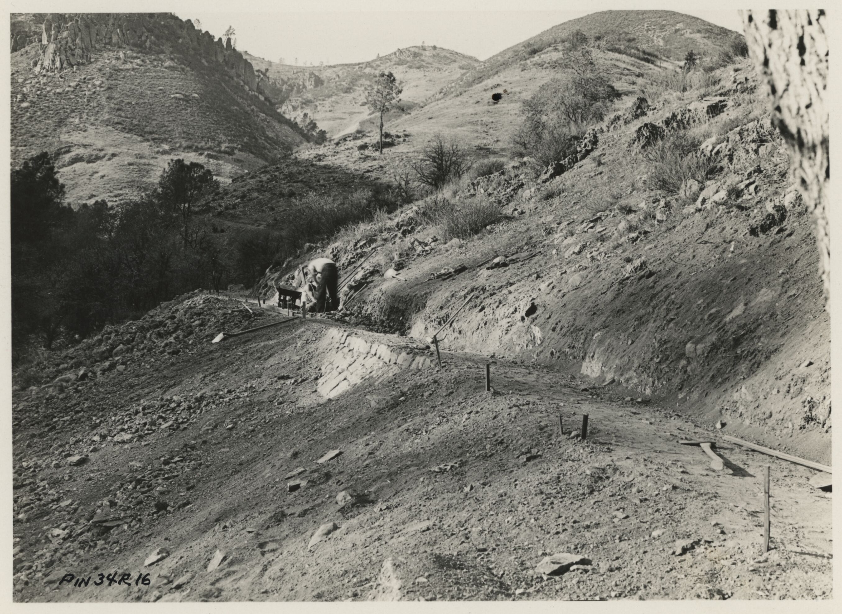
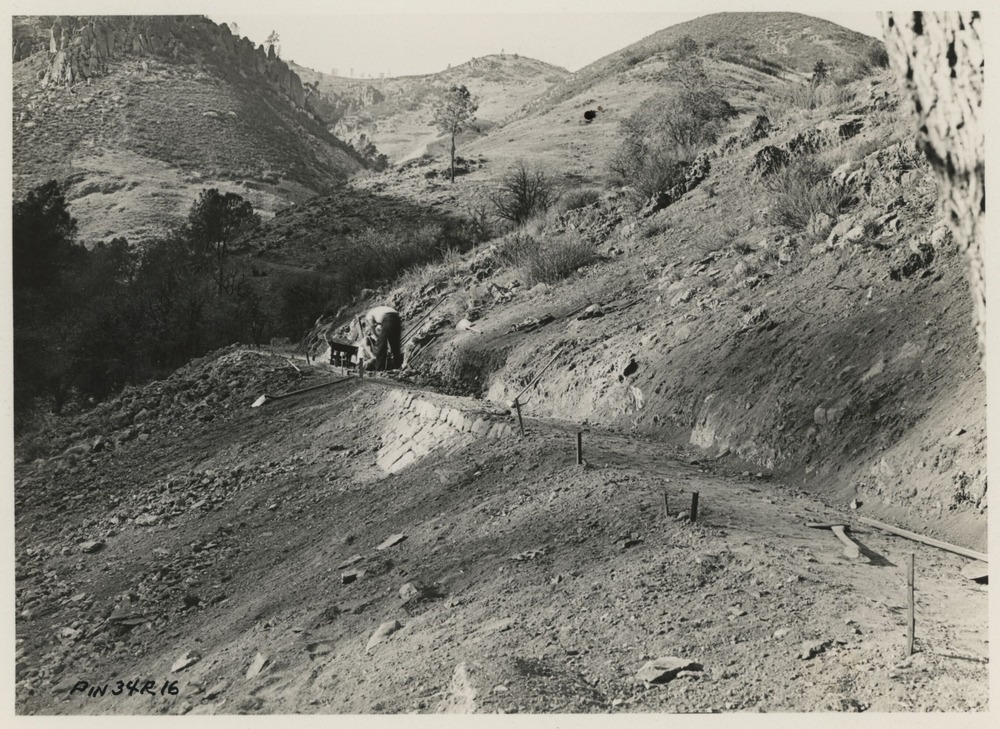
High Peaks Trail
High Peaks Trail
Newly completed section of High Peaks Trail.
U.S. National Parks Service
This digital asset is in the public domain. When using this asset for any purpose, including online, credit: 'Courtesy U.S. National Parks, Pinnacles National Park'
NPS / C.O. Roberts
Public domain
Image
Pinnacles National Park, Code: PINN
Pinnacles National Park, California
Latitude: 36.4753494262695, Longitude: -121.173400878906
Latitude: 36.4753494262695, Longitude: -121.173400878906
1934
Original ID PIN34R16, "Revised line of High Peaks Trail above utility area. ECW project.", 4.25 x 3.25 inches
Catalog NO: 4372 ; Box NO: Binder 2 ; Location: FOVA munitions
Public Can View
Organization: Pinnacles National Park
Address: 5000 East Entrance Rd., Paicines, CA 95043, tel: 831-389-4486
Address: 5000 East Entrance Rd., Paicines, CA 95043, tel: 831-389-4486
Tuesday, May 20, 2025 4:43:16 PM
Tuesday, May 20, 2025 4:43:16 PM
PINN_4372_0239.tif
tif
9.5 MB
Historic