Select Item below to DOWNLOAD - Once item is selected, right click and choose 'save as'
fd580d0c-2550-4e69-a973-d6d80367add3
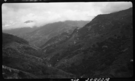
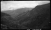
Chaparral Plant Community, 4400', East Fork Kaweah River Canyon, Type Map.
SEKI Historic Image
Chaparral Plant Community, 4400', East Fork Kaweah River Canyon, Type Map.
National Park Service
M. Mitchell, 361020, Lookout Point area, SNP, Chaparral Plant Community, 4400', East Fork Kaweah River Canyon, Type Map.
Permission must be secured from the individual copyright owners to reproduce any copyrighted materials contained within this website. Digital assets without any copyright restrictions are public domain.
Public domain
Image
Lookout Point area, Tulare County, California
10/20/1936
option 1
Tuesday, January 10, 2017 1:02:16 PM
Tuesday, January 10, 2017 1:02:16 PM
08203.tif
Monday, January 1, 0001 12:00:00 AM
tif
14.7 MB
Scenic
,
Historic