Select Item below to DOWNLOAD - Once item is selected, right click and choose 'save as'
fd30eac1-fb72-47e4-b8ef-b346ef429158
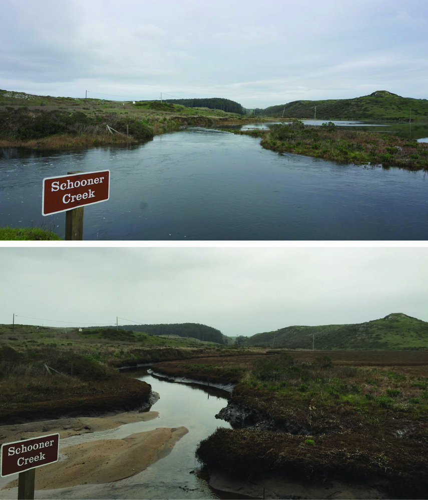
Photographs of the Potential Impacts of Sea Level Rise on Schooner Creek.
Photographs of the potential impacts of sea level rise on Schooner Creek.
Top photograph is a King Tide and bottom photograph, taken 6 hours later, is a negative tide. The King Tide shows what could be the new normal with sea level rise.
Permission must be secured from the individual copyright owners to reproduce any copyrighted materials contained within this website. Digital assets without any copyright restrictions are public domain.
NPS photographs.
Public domain:Full Granting Rights
Image
Point Reyes National Seashore, Code: PORE
Point Reyes National Seashore, Marin County, California
Latitude: 38.0550003051758, Longitude: -122.879997253418
Latitude: 38.0550003051758, Longitude: -122.879997253418
01/01/0001
Public Can View
Tuesday, July 27, 2021 2:12:48 PM
Tuesday, July 27, 2021 4:00:32 PM
48.jpg
Monday, January 1, 0001 12:00:00 AM
jpg
7.1 MB
Scenic