Select Item below to DOWNLOAD - Once item is selected, right click and choose 'save as'
fcd468be-c609-421d-991c-40b58d8a8c24
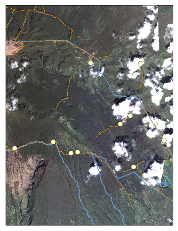
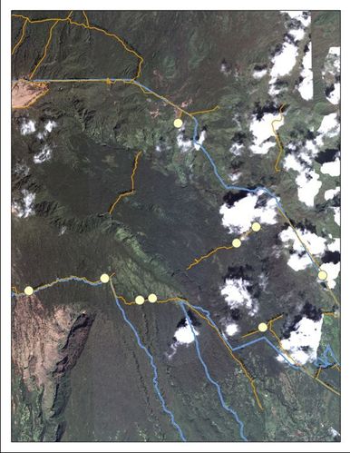
PMIS #167510 - Figure 2. Photo shows rainforest fence lines in yellow and park boundary in blue. Dots denote locations of natural barriers that are subject to trespass by feral animals.
Figure 2. Photo shows rainforest fence lines in yellow and park boundary in blue. Dots denote locations of natural barriers that are subject to trespass by feral animals.
Figure 2. Photo shows rainforest fence lines in yellow and park boundary in blue. Dots denote locations of natural barriers that are subject to trespass by feral animals.
Permission must be secured from the individual copyright owners to reproduce any copyrighted materials contained within this website. Digital assets without any copyright restrictions are public domain.
Public domain
Image
Haleakala National Park, Code: HALE
Haleakala National Park, Maui County, Hawaii
Latitude: 20.7073001861572, Longitude: -156.149002075195
Latitude: 20.7073001861572, Longitude: -156.149002075195
01/01/1991 - 12/31/2010
Public Can View
Monday, April 11, 2011 4:43:22 PM
Thursday, August 10, 2017 2:50:35 PM
HALE-c3d75e698b444855a8689b58351ea2e7.tif
Monday, January 1, 0001 12:00:00 AM
tif
1.0 MB
Budget