Select Item below to DOWNLOAD - Once item is selected, right click and choose 'save as'
fb9de4b3-0783-4902-a076-cede55708581
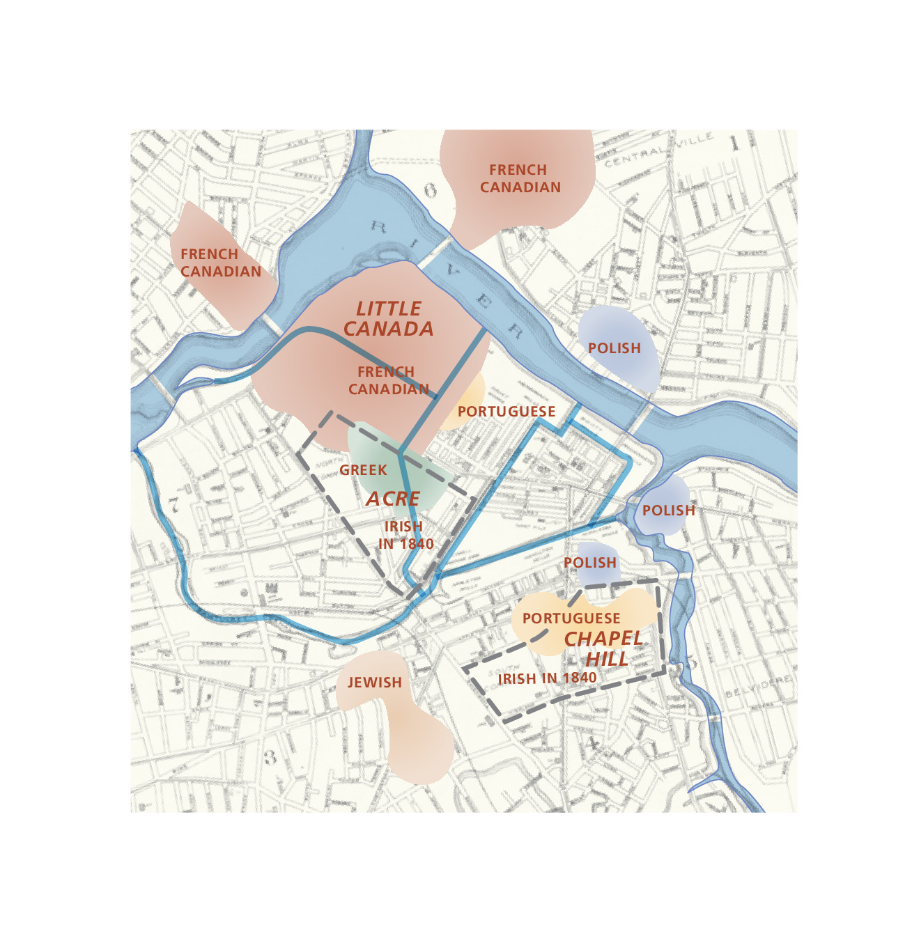
Ethnic Enclaves, 1912 Map - Lowell National Historical Park
Map of the ethnic enclaves in Lowell National Historical Park in Massachusetts in 1912. A historic map has a beige background and gray streets representing the street grid. Different areas of color represent ethnicities. Red is labeled French-Canadian, yellow is for Portuguese, blue for Polish, green for Greek, and light orange for Jewish.
Screen-viewable file; Adobe print production files can be downloaded from the Compressed zip Version link
Map Projection: Other; Map Type: unassigned
U.S. National Park Service
The National Park Service maps are government produced and are in the public domain. Anyone may, without restriction under U.S. copyright laws: Reproduce the work in print or digital form; Create derivative works; Perform the work publicly; Display the work; Distribute copies or digitally transfer the work to the public by sale or other transfer of ownership, or by rental, lease, or lending. Please note, a user who modifies and/or republishes National Park Service maps are responsible for any problems encountered with the maps, due to their change or modification.
Public domain
Document
Lowell National Historical Park, Code: LOWE
Lowell National Historical Park, Middlesex County, Massachusetts
Latitude: 42.6464996337891, Longitude: -71.3309020996094
Latitude: 42.6464996337891, Longitude: -71.3309020996094
2015-06-18
Public Can View
Person: Harpers Ferry Center
Organization: US National Park Service
Address: Harpers Ferry Center, Harpers Ferry, WV
Email: HFC_Cartography@nps.gov
Organization: US National Park Service
Address: Harpers Ferry Center, Harpers Ferry, WV
Email: HFC_Cartography@nps.gov
Wednesday, April 27, 2022 7:44:39 PM
Friday, September 26, 2025 11:36:25 PM
LOWEmap5.pdf
pdf
392.2 kB
Map