Select Item below to DOWNLOAD - Once item is selected, right click and choose 'save as'
The National Park Service is committed to making its electronic and information technologies accessible to individuals with disabilities.
If you require assistance or wish to report an issue related to the accessibility of any content on this website, please email NPGallery@nps.gov
If you require assistance or wish to report an issue related to the accessibility of any content on this website, please email NPGallery@nps.gov
f92f2144-86f7-42cc-a551-944ac2459504
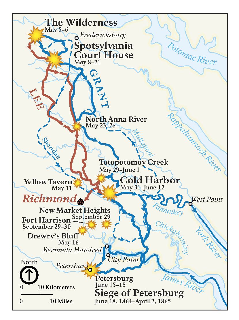
1864 Map - Richmond National Battlefield Park
Map of the notable battles of Richmond National Battlefield Park circa 1864. Grant’s movements are shown in blue and Lee’s are shown in red. Battles are represented as yellow-orange sunbursts, dotting the trail at intersections where the two paths meet.
Screen-viewable file; Adobe print production files can be downloaded from the Compressed zip Version link
Map Projection: Other; Map Type: unassigned
U.S. National Park Service
The National Park Service maps are government produced and are in the public domain. Anyone may, without restriction under U.S. copyright laws: Reproduce the work in print or digital form; Create derivative works; Perform the work publicly; Display the work; Distribute copies or digitally transfer the work to the public by sale or other transfer of ownership, or by rental, lease, or lending. Please note, a user who modifies and/or republishes National Park Service maps are responsible for any problems encountered with the maps, due to their change or modification.
Public domain
Document
Richmond National Battlefield Park, Code: RICH
Richmond National Battlefield Park, Virginia
Latitude: 37.4178581237793, Longitude: -77.2514038085938
Latitude: 37.4178581237793, Longitude: -77.2514038085938
2022-10-01
10/01/2022
Public Can View
Person: Harpers Ferry Center
Organization: US National Park Service
Address: Harpers Ferry Center, Harpers Ferry, WV
Email: HFC_Cartography@nps.gov
Organization: US National Park Service
Address: Harpers Ferry Center, Harpers Ferry, WV
Email: HFC_Cartography@nps.gov
Monday, June 5, 2023 10:23:15 PM
Friday, September 26, 2025 11:37:15 PM
RICHmap4.pdf
pdf
328.0 kB
Map