Select Item below to DOWNLOAD - Once item is selected, right click and choose 'save as'
f8564c78-1bde-47a4-ad21-53f935ff9cee
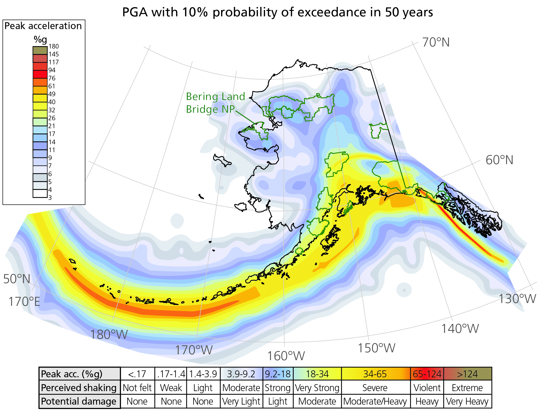
Earthquake Probability Map of Alaska.
Map showing the probability of earthquakes in Alaska. Highest probability is along the island chain. Bering Land Bridge National Preserve has low to moderate probability.
The map shows the peak ground acceleration (PGA) with 10% probability of exceedance in 50 years. This means the map is showing the greatest amount of ground acceleration (as a percentage of the acceleration of gravity) produced by an earthquake that has the probability of 10% to occur in the next
50 years. Green outlines are National Park System units. Bearing Land Bridge National Preserve (NP) is labelled.
Permission must be secured from the individual copyright owners to reproduce any copyrighted materials contained within this website. Digital assets without any copyright restrictions are public domain.
Map modified from Wesson et al. (2007). Table values from Wald et al. (1999), which were developed for southern California but provide a general sense of perceived shaking and damage for earthquakes elsewhere.
Public domain:Full Granting Rights
Image
Bering Land Bridge National Preserve, Code: BELA
Bering Land Bridge National Preserve, Alaska
Latitude: 66.2151489257813, Longitude: -165.126602172852
Latitude: 66.2151489257813, Longitude: -165.126602172852
01/01/0001
Public Can View
Friday, July 2, 2021 2:51:14 PM
Friday, July 2, 2021 2:51:14 PM
Fig 48_Earthquake probability map 2007 BELA-01.jpg
Monday, January 1, 0001 12:00:00 AM
jpg
2.3 MB
Scenic