Select Item below to DOWNLOAD - Once item is selected, right click and choose 'save as'
f8153313-555b-48df-8574-a2a042fed9a4
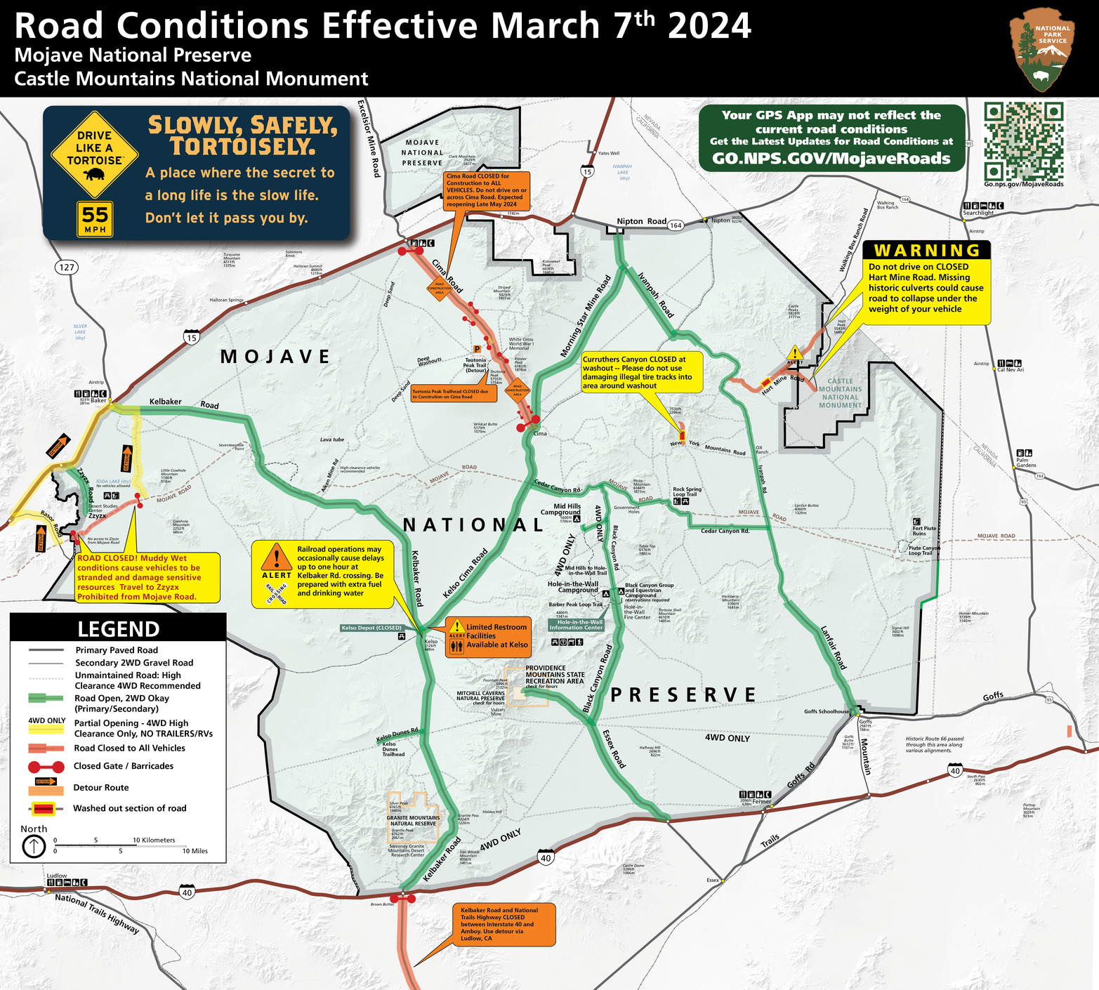
March 07 2024 Soda Lake Closed Cima Rd Closed Piute Gorge Opens-01.png
Road conditions map with closed roads color coded red, which includes Cima Road in the north central part of the map, Mojave Road on the Soda Lake Section in the western boundary, and Kelbaker Road outside the preserve to the south of the boundary.
Road Conditions Map for Mojave National Preserve Effective March 7th, 2024
Permission must be secured from the individual copyright owners to reproduce any copyrighted materials contained within this website. Digital assets without any copyright restrictions are public domain.
NPS / MOJA Media
Public domain:Full Granting Rights
Image
Castle Mountains National Monument, Code: CAMO
Mojave National Preserve, Code: MOJA
Mojave National Preserve, Code: MOJA
Castle Mountains National Monument
Mojave National Preserve, San Bernardino County, California
Latitude: 35.114200592041, Longitude: -115.514999389648
Mojave National Preserve, San Bernardino County, California
Latitude: 35.114200592041, Longitude: -115.514999389648
03/07/2024
Public Can View
Friday, March 8, 2024 1:01:07 AM
Friday, March 8, 2024 1:04:26 AM
March 07 2024 Soda Lake Closed Cima Rd Closed Piute Gorge Opens-01.png
png
15.9 MB
Scenic