Select Item below to DOWNLOAD - Once item is selected, right click and choose 'save as'
f69bfd13-d78c-49a9-943b-e27fd6328859
Playalinda Sand Dune.jpg
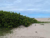
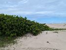
Playalinda sand dune vegetation on the left and sand on the right. Some cloud coverage in the skies.
Playalinda sand dune vegetation on the left and sand on the right. Some cloud coverage in the skies.
Permission must be secured from the individual copyright owners to reproduce any copyrighted materials contained within this website. Digital assets without any copyright restrictions are public domain.
NPS Employee
Public domain:Full Granting Rights
Image
Canaveral National Seashore, Code: CANA
Canaveral National Seashore, Florida
Latitude: 28.7782001495361, Longitude: -80.7477722167969
Latitude: 28.7782001495361, Longitude: -80.7477722167969
01/01/0001
Public Can View
Tuesday, April 1, 2025 3:32:25 PM
Tuesday, April 1, 2025 3:57:03 PM
Picture13.jpg
Monday, January 1, 0001 12:00:00 AM
jpg
435.4 kB
Scenic