Select Item below to DOWNLOAD - Once item is selected, right click and choose 'save as'
f3aff2d1-740d-46f6-a74c-fe9f15d826bc
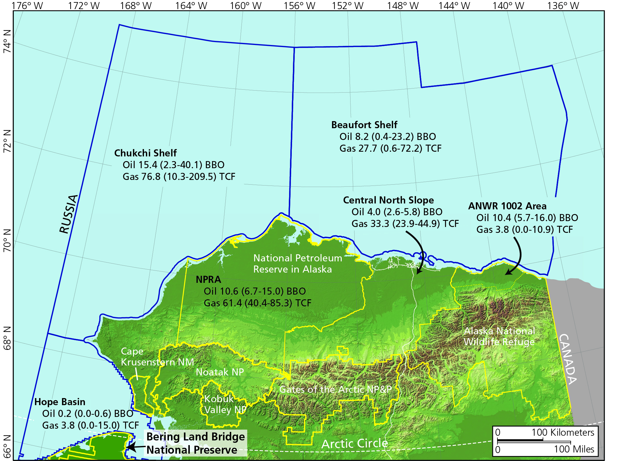
Undiscovered Oil and Gas
Map showing estimated undiscovered oil and gas resources in northern Alaska. National Park Service boundaries are delineated in yellow.
The map shows the estimates of undiscovered oil (in billions of barrels [BBO]) and gas (in trillions of cubic feet [TCF]) for federal onshore and offshore assessment areas in northern Alaska. The oil and gas estimates are the mean (first number) and range (in parentheses) of the 90% confidence interval. The Hope basin in this figure combines both the Kotzebue and Hope basins, which are managed together under the Hope Basin Planning Area.
Permission must be secured from the individual copyright owners to reproduce any copyrighted materials contained within this website. Digital assets without any copyright restrictions are public domain.
Modified from Houseknecht and Bird (2005).
Public domain:Full Granting Rights
Image
Bering Land Bridge National Preserve, Code: BELA
Bering Land Bridge National Preserve, Alaska
Latitude: 66.2151489257813, Longitude: -165.126602172852
Latitude: 66.2151489257813, Longitude: -165.126602172852
01/01/0001
Public Can View
Friday, July 2, 2021 2:51:14 PM
Friday, July 2, 2021 2:51:14 PM
Fig 51_Oil and gas potental resources arctic Alaska.jpg
Monday, January 1, 0001 12:00:00 AM
jpg
4.3 MB
Scenic