Select Item below to DOWNLOAD - Once item is selected, right click and choose 'save as'
f3a08415-e1fc-477b-9527-881d72be0f76
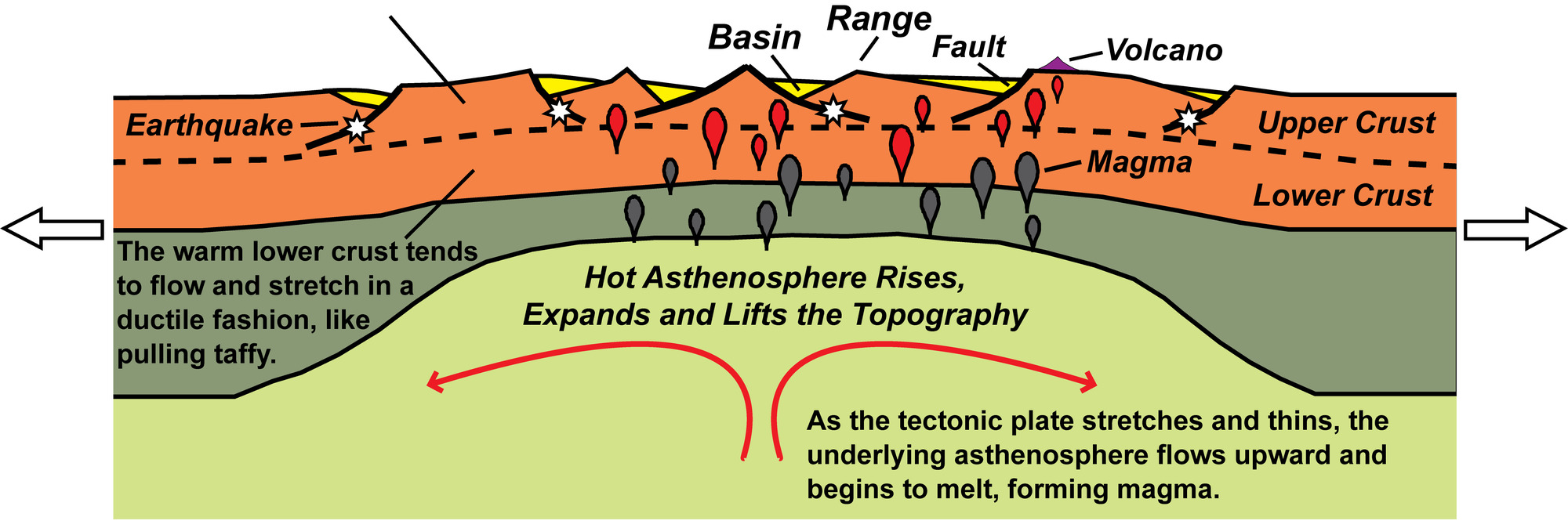
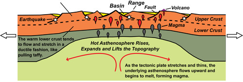
Continental Rift: Topography, Earthquakes and Volcanism
illustration of upper layers of the earth where they are being spread and thinned—under going continental rifting.
The Basin and Range topography develops over a few million years as fault lines move gradually, or more abruptly during tens of thousands of earthquakes. The colder upper crust cracks and breaks along faults (like peanut brittle), causing earthquakes and forming long mountains (ranges) separated by valleys (basins). Magma reaching the surface erupts from volcanoes and fissures as lava flows and other volcanic materials, mingling with river and lake sediments to fill rift valleys. Ripping a tectonic plate apart elevates the region and causes earthquakes, volcanic eruptions and the formation of long mountain ranges separated by broad valleys (basins).
Permission must be secured from the individual copyright owners to reproduce any copyrighted materials contained within this website. Digital assets without any copyright restrictions are public domain.
Modified from Beauty from the Beast: Plate Tectonics and the Landscapes of the Pacific Northwest,” by Robert J. Lillie, Wells Creek Publishers, 92 pp., 2015, www.amazon.com/dp/1512211893.
Public domain:Full Granting Rights
Image
Geologic Resources Division, Code: GRD
09/26/2019
09/26/2019
Public Can View
Wednesday, October 9, 2019 10:07:33 AM
Wednesday, October 9, 2019 10:07:33 AM
continental rift topography@10x.jpg
Thursday, September 26, 2019 2:52:36 PM
jpg
1.8 MB
Scenic