Select Item below to DOWNLOAD - Once item is selected, right click and choose 'save as'
efcb519a970f4ed2bed19e184931466d
Post-flood
Post-flood
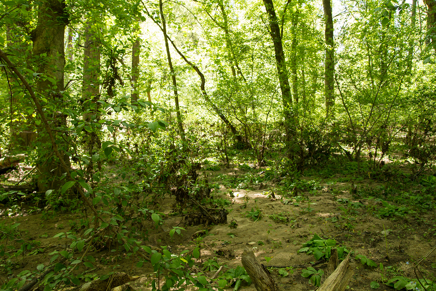
Floodplain communities are "scoured" by flood waters frequently. Inhabitants must be able to tolerate disturbance and saturated soil. Note the debris left 2+ ft high in the shrubs, showing the height of the recent flood waters.Photographer: Sam Sheline, courtesy of NatureServe; Tuliptree Small-Stream Floodplain Forest on Valley Trail/Black H; Stream and Riparian (Central Appalachian);
U.S. National Park Service
Copyright free and in the public domain.
NPS / Sam Sheline;
Public domain
Image
National Capital Region, Code: NCR
Rock Creek Park, Code: ROCR
Rock Creek Park, Code: ROCR
Rock Creek Park
Latitude: 38.9315490722656, Longitude: -77.0459899902344
Latitude: 38.9315490722656, Longitude: -77.0459899902344
2014/05/06
05/06/2014
Public Can View
Person: Program Manager
Organization: US National Park Service
Address: National Capital Region
Organization: US National Park Service
Address: National Capital Region
Friday, December 18, 2020 3:39:31 PM
Friday, December 18, 2020 3:39:31 PM
15552613001.jpg
jpg
2.2 MB
Scenic