Select Item below to DOWNLOAD - Once item is selected, right click and choose 'save as'
edc47cce-edcb-4947-80ea-b45e1804e141
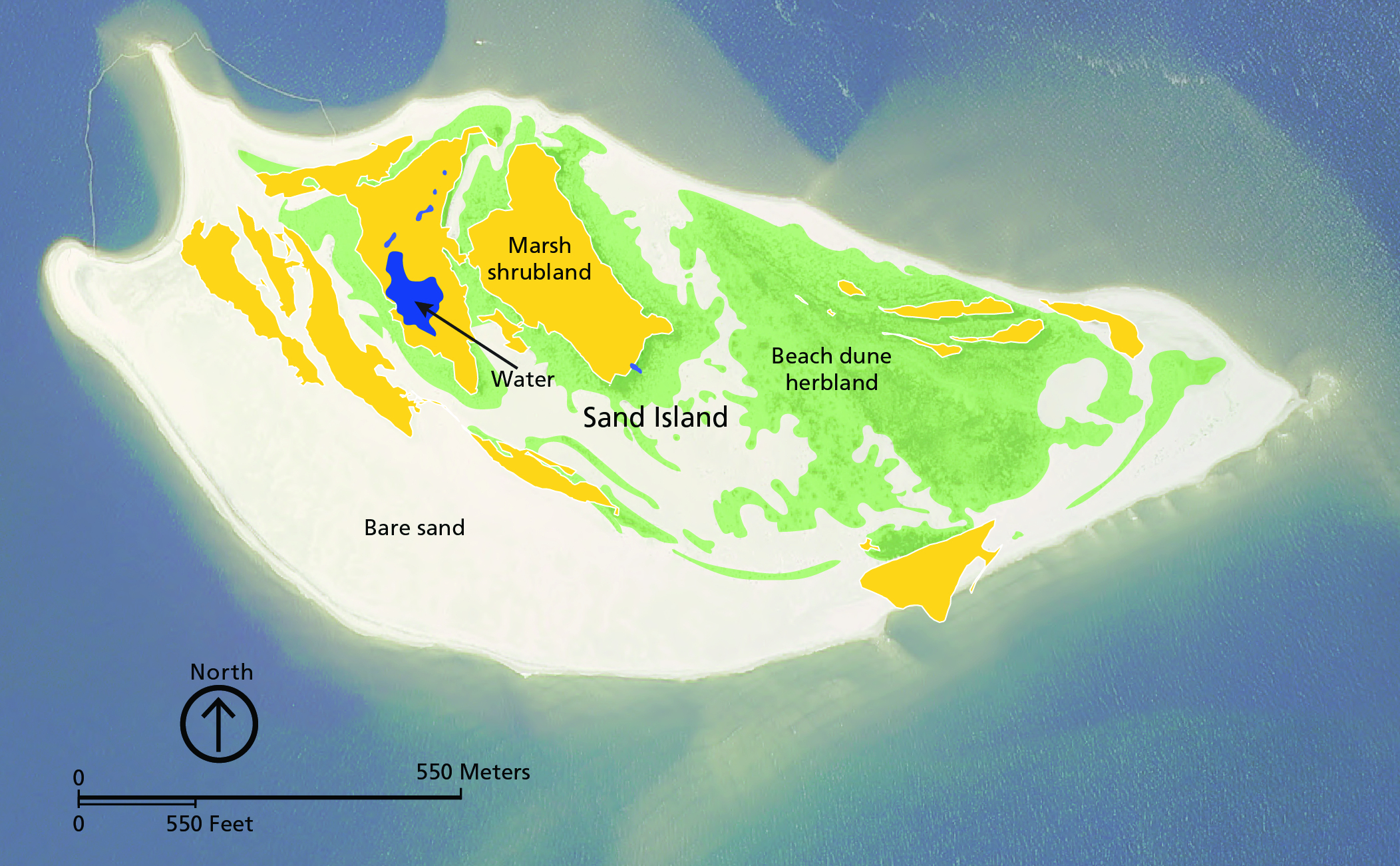
Geomorphic/Habitat Map of Sand Island
Geomorphic/habitat map of Sand Island.
The map illustrates ecological habitats and geomorphic features of Sand Island (also known as “West Petit Bois Island”), which is part of the USACE Disposal Area 10 (DA-10). Interior wetlands are present on the island. The island has areas of marsh shrubland (yellow), beach dune herbland (green), water (blue), and bare sand (white). Mapping of Sand Island is not included in the GRI GIS data.
Permission must be secured from the individual copyright owners to reproduce any copyrighted materials contained within this website. Digital assets without any copyright restrictions are public domain.
Graphic by Trista Thornberry-Ehrlich (Colorado State University) based on Anderson et al. (2016a, figure 2) and NPS data
from May 2013 courtesy of Jolene Williams (Gulf Islands National Seashore).
Public domain:Full Granting Rights
Image
Gulf Islands National Seashore, Code: GUIS
Gulf Islands National Seashore
Latitude: 30.3730602264404, Longitude: -86.9099731445313
Latitude: 30.3730602264404, Longitude: -86.9099731445313
01/01/0001
Public Can View
Monday, June 14, 2021 12:27:00 PM
Monday, June 14, 2021 12:27:00 PM
Figure 7 GUIS_Map Sand Island Wetlands mpk_0516-2019_tte-01.jpg
Monday, January 1, 0001 12:00:00 AM
jpg
3.5 MB
Scenic