Select Item below to DOWNLOAD - Once item is selected, right click and choose 'save as'
ed936733a1f5446182588c8f04cbe1d6
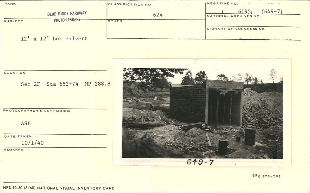
12' x 12' box culvert
12' x 12' box culvert
Section 2-F, Station 652+74, Milepost 288.8
U.S. National Park Service
Permission must be secured from the individual copyright owners to reproduce any copyrighted materials contained within this website.
Albert S. Burns
Public domain
Culvert, (Blue Ridge Parkway Construction Project)
Image
Blue Ridge Parkway, Code: BLRI
Milepost 288, Blue Ridge Parkway
Blue Ridge Parkway
Latitude: 36.4365005493164, Longitude: -81.070556640625
Blue Ridge Parkway
Latitude: 36.4365005493164, Longitude: -81.070556640625
October 1, 1940
10/01/1940
Public Can View
Organization: US National Park Service
Role: Museum Curator
Address: Blue Ridge Parkway Headquarters
Email: blri_info@nps.gov
Role: Museum Curator
Address: Blue Ridge Parkway Headquarters
Email: blri_info@nps.gov
Friday, February 7, 2020 9:18:41 AM
Friday, February 7, 2020 9:18:41 AM
0008_MP288_1.tif
tif
10.8 MB
Scenic
,
Historic