Select Item below to DOWNLOAD - Once item is selected, right click and choose 'save as'
ebd61410-feb5-43da-bec4-f8d18b0c9ba4
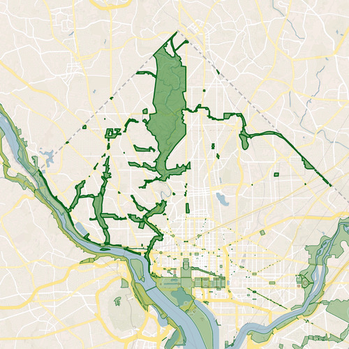
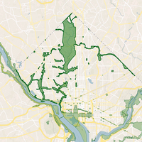
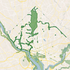
GIS Bookmark Icon for Rock Creek Park
graphic of outline of park jurisdictional boundary
Square icon showing park boundary for use in bookmark menus in GIS platforms, such as Portal for the NPS and ArcGIS Online for the NPS. This image should NOT be used to determine the legal park boundary.
Permission must be secured from the individual copyright owners to reproduce any copyrighted materials contained within this website. Digital assets without any copyright restrictions are public domain.
Public domain
Image
Rock Creek Park, Code: ROCR
Rock Creek Park
Latitude: 38.9315490722656, Longitude: -77.0459899902344
Latitude: 38.9315490722656, Longitude: -77.0459899902344
11/18/2024
Public Can View
Person: Cynthia Wanschura
Organization: National Capital Region, National Park Service
Role: Publisher
Position: Regional GIS Coordinator
Address: 1100 Ohio Drive, SW, Washington, DC 20242
Email: cynthia_wanschura@nps.gov
Organization: National Capital Region, National Park Service
Role: Publisher
Position: Regional GIS Coordinator
Address: 1100 Ohio Drive, SW, Washington, DC 20242
Email: cynthia_wanschura@nps.gov
Monday, November 18, 2024 7:22:47 PM
Monday, November 18, 2024 7:31:23 PM
ROCR_Boundary_Outline_300.png
png
5.7 MB
Map