Select Item below to DOWNLOAD - Once item is selected, right click and choose 'save as'
e90a27b1-eb6b-4f48-bcc4-4be31993ce03
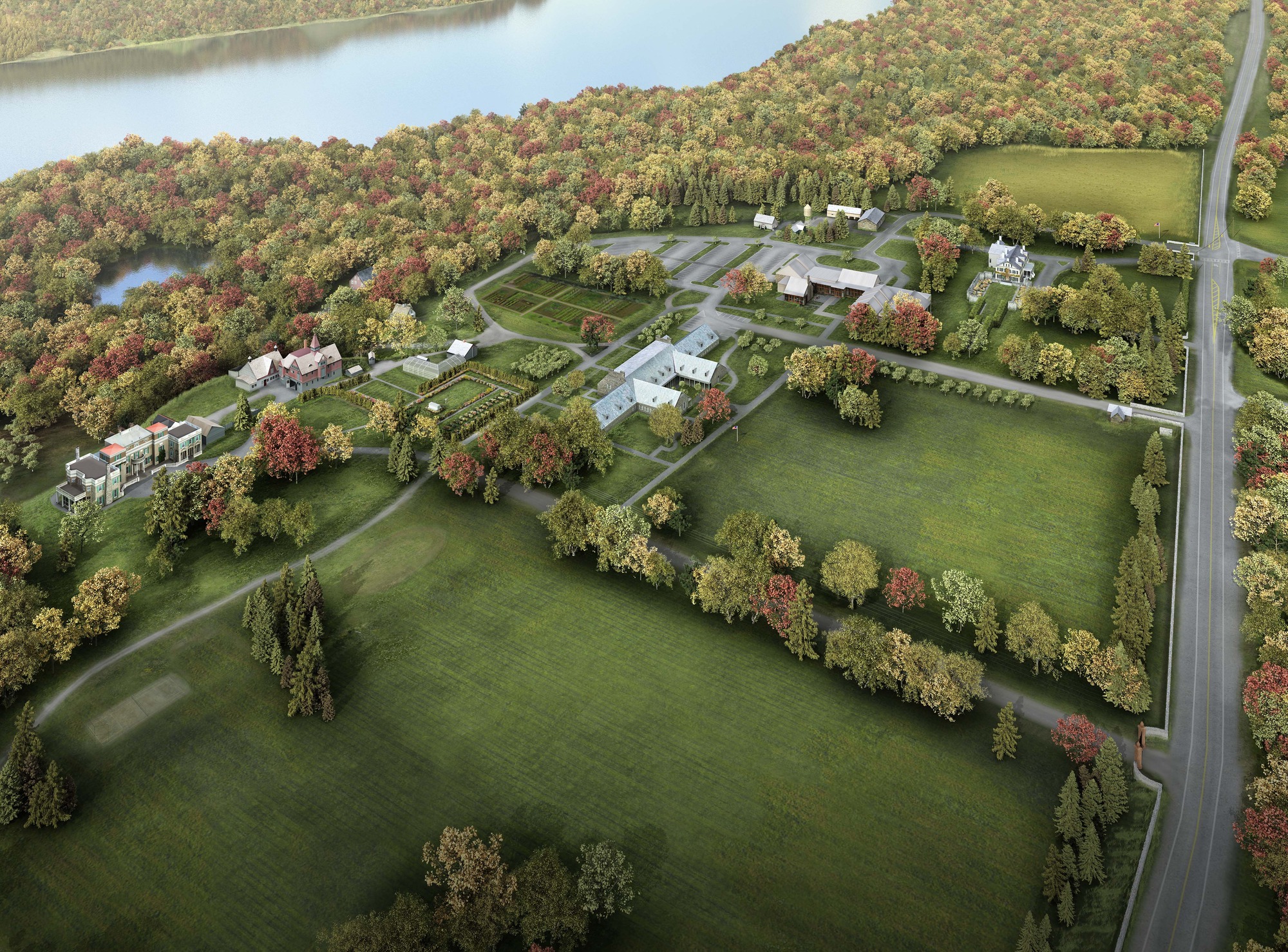
HOFR Brochure Orientation Map
An artist's rendering of a birdseye view of the park nestled between the Hudson River and Route 9 to each side. The map includes roads, parking lots, gardens, the visitor center, the Roosevelt home, the Presidential LIbrary, and several garages and stables.
BIrdseye View of the park.
Permission must be secured from the individual copyright owners to reproduce any copyrighted materials contained within this website. Digital assets without any copyright restrictions are public domain.
National Park Service, Home of Franklin D. Roosevelt National Historic Site
Public domain:Full Granting Rights
Image
Home of Franklin D. Roosevelt National Historic Site, Code: HOFR
Home of Franklin D. Roosevelt National Historic Site, Dutchess County, New York
Latitude: 41.7680015563965, Longitude: -73.9266967773438
Latitude: 41.7680015563965, Longitude: -73.9266967773438
07/14/2015
07/14/2015
Public Can View
Monday, February 26, 2024 5:17:50 PM
Monday, February 26, 2024 5:26:06 PM
HOFR Brochure Orientation Map with Garden.jpg
Tuesday, July 14, 2015 2:06:10 PM
jpg
3.4 MB
Scenic