Select Item below to DOWNLOAD - Once item is selected, right click and choose 'save as'
e8d5b860-99b4-44e3-ade0-76c77ed9ab0a
Fishing area.jpg
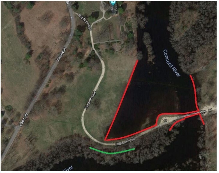
Arial photograph of the North Bridge area, green meadow land and a river from top to bottom of image on the right side. A green line marks the area on the center/bottom of the image beside the river.
Arial photograph of the North Bridge area, green meadow land and a river from top to bottom of image on the right side. A green line marks the area on the center/bottom of the image beside the river.
Permission must be secured from the individual copyright owners to reproduce any copyrighted materials contained within this website. Digital assets without any copyright restrictions are public domain.
Public domain:Full Granting Rights
Image
Minute Man National Historical Park, Code: MIMA
Minute Man National Historical Park, Middlesex County, Massachusetts
Latitude: 42.4533996582031, Longitude: -71.2959976196289
Latitude: 42.4533996582031, Longitude: -71.2959976196289
01/01/0001
Public Can View
Saturday, August 14, 2021 2:04:10 PM
Saturday, August 14, 2021 2:07:38 PM
Fishing area.jpg
Monday, January 1, 0001 12:00:00 AM
jpg
96.1 kB
Scenic