Select Item below to DOWNLOAD - Once item is selected, right click and choose 'save as'
e72e44fc-279c-432f-bd0c-86032fb52caf
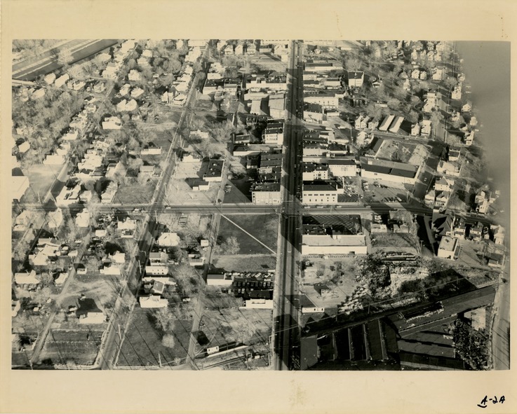
Aerial view of West Dayton, A-2
Aerial view of West Dayton, A-2
Aerial view of West Dayton, A-2
Permission must be secured from the individual copyright owners to reproduce any copyrighted materials contained within this website. Digital assets without any copyright restrictions are public domain.
Public domain
Image
Dayton Aviation Heritage National Historical Park, Code: DAAV
Dayton Aviation Heritage National Historical Park, Ohio
Latitude: 39.8045883178711, Longitude: -84.0637588500977
Latitude: 39.8045883178711, Longitude: -84.0637588500977
2022/04/08
No Date
Public Can View
Organization: DAAV
Friday, April 8, 2022 8:14:31 PM
Wednesday, April 13, 2022 9:00:15 PM
A-2.tif
Monday, January 1, 0001 12:00:00 AM
tif
50.2 MB
Historic