Select Item below to DOWNLOAD - Once item is selected, right click and choose 'save as'
The National Park Service is committed to making its electronic and information technologies accessible to individuals with disabilities.
If you require assistance or wish to report an issue related to the accessibility of any content on this website, please email NPGallery@nps.gov
If you require assistance or wish to report an issue related to the accessibility of any content on this website, please email NPGallery@nps.gov
e3797553-9e84-44bd-a091-0415b2b649a8
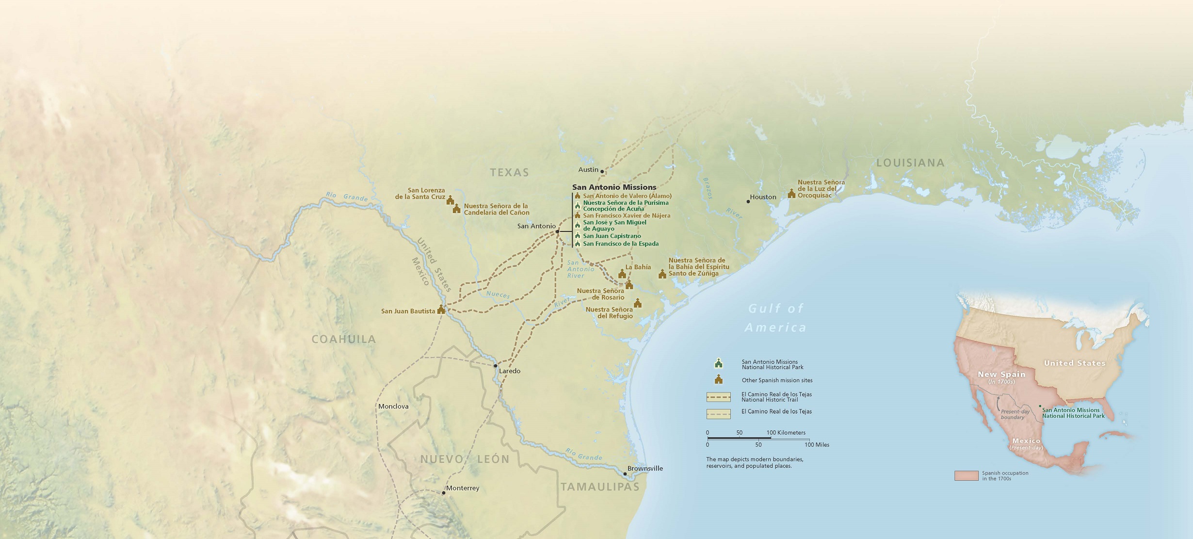
Regional Mission Map - San Antonio Missions National Historical Park
Map showing the locations of missions, including those belonging to San Antonio Missions National Historical Park in Texas. San Antonio missions are shown as green building icons and other Spanish mission sites are shown in brown. The terrain is represented in pale green and tan, and the Gulf of America in blue.
Screen-viewable file; Adobe print production files can be downloaded from the Compressed zip Version link
Map Projection: UTM; Map Type: area map
U.S. National Park Service
The National Park Service maps are government produced and are in the public domain. Anyone may, without restriction under U.S. copyright laws: Reproduce the work in print or digital form; Create derivative works; Perform the work publicly; Display the work; Distribute copies or digitally transfer the work to the public by sale or other transfer of ownership, or by rental, lease, or lending. Please note, a user who modifies and/or republishes National Park Service maps are responsible for any problems encountered with the maps, due to their change or modification.
Public domain
Document
San Antonio Missions National Historical Park, Code: SAAN
San Antonio Missions National Historical Park, Texas
Latitude: 29.3323307037354, Longitude: -98.4542465209961
Latitude: 29.3323307037354, Longitude: -98.4542465209961
2025/02/11
12/01/2021
Public Can View
Person: Harpers Ferry Center
Organization: US National Park Service
Address: Harpers Ferry Center, Harpers Ferry, WV
Email: HFC_Cartography@nps.gov
Organization: US National Park Service
Address: Harpers Ferry Center, Harpers Ferry, WV
Email: HFC_Cartography@nps.gov
Wednesday, February 12, 2025 2:14:14 PM
Friday, September 26, 2025 11:37:20 PM
SAANmap5.pdf
pdf
117.0 MB
Map