Select Item below to DOWNLOAD - Once item is selected, right click and choose 'save as'
e3573539-f66c-4c98-920b-7d97e42f7b4c
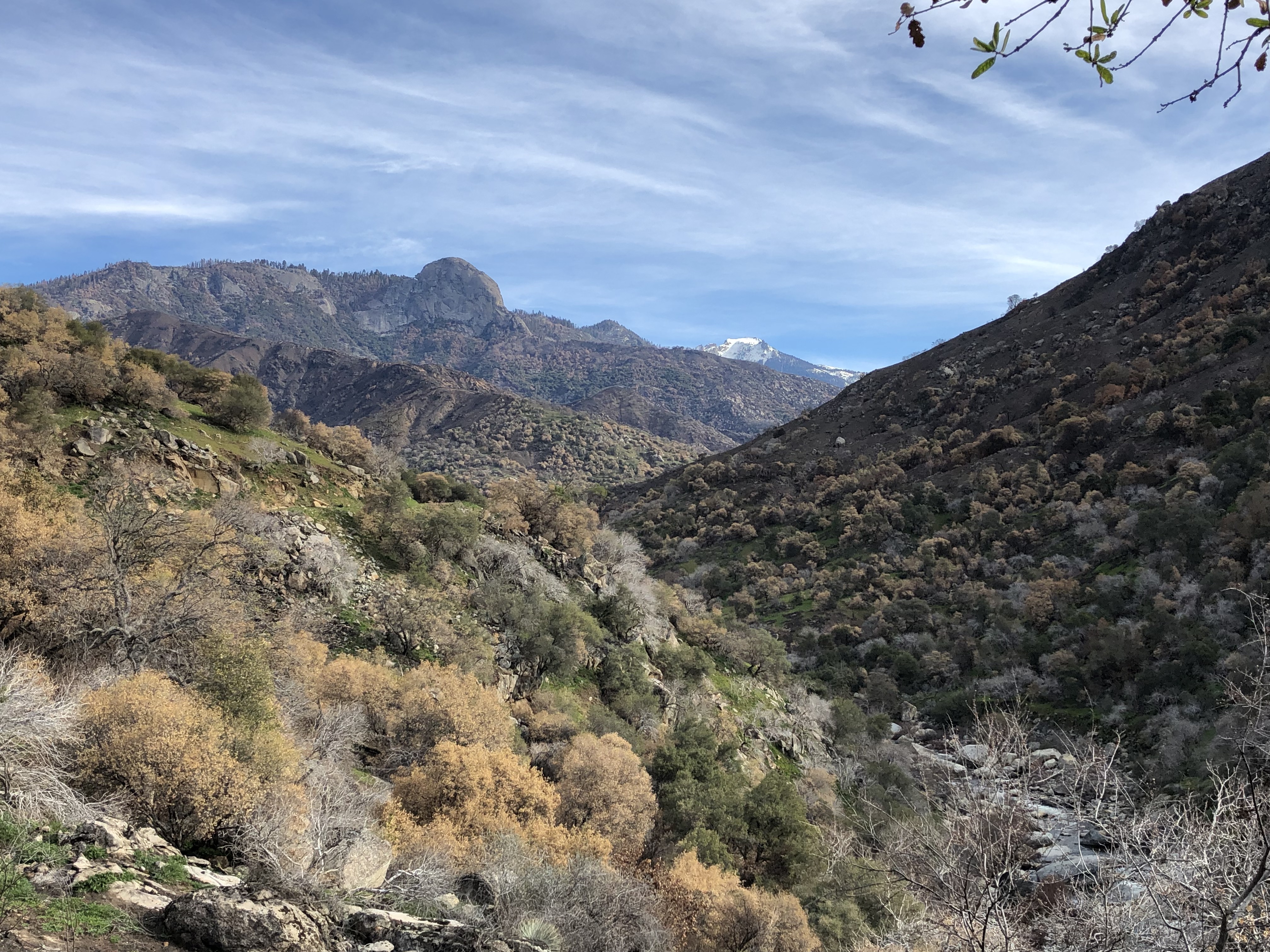
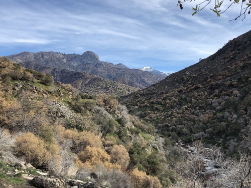
From the Foothills to Moro Rock
Grasses resprout in the foreground, and looking upcanyon, oak trees and other hardwoods are browned in some areas and green in others, while places where chamise shrubs grew in the distance are now blackened slopes until they begin to resprout!
Fire effects vary by vegetation, slope direction, and elevation. Here small plants regrow, and shrublands and oak woodlands show low to moderate to high fire severity.
Permission must be secured from the individual copyright owners to reproduce any copyrighted materials contained within this website. Digital assets without any copyright restrictions are public domain.
Christie Hendrix, National Park Service
Public domain:Full Granting Rights
Image
Sequoia and Kings Canyon National Parks, Code: SEKI
Sequoia and Kings Canyon National Parks, California
Latitude: 36.7172584533691, Longitude: -118.537902832031
Latitude: 36.7172584533691, Longitude: -118.537902832031
01/28/2022 | January 28, 2022
01/28/2022
Public Can View
Friday, April 29, 2022 11:15:58 PM
Friday, April 29, 2022 11:40:45 PM
NearTunnelRock_KNPComplex_SEKI_CHendrix_20220128.JPG
Apple Apple, iPhone 8 20, iPhone 8 back camera 3.99mm f/1.8
1/960 sec at f / 1.8
3.99 mm
ISO 20
Friday, January 28, 2022 9:26:39 AM
jpg
4.0 MB
Scenic