Select Item below to DOWNLOAD - Once item is selected, right click and choose 'save as'
e30e71b4-2f6a-42e7-996c-109a92a0aa13
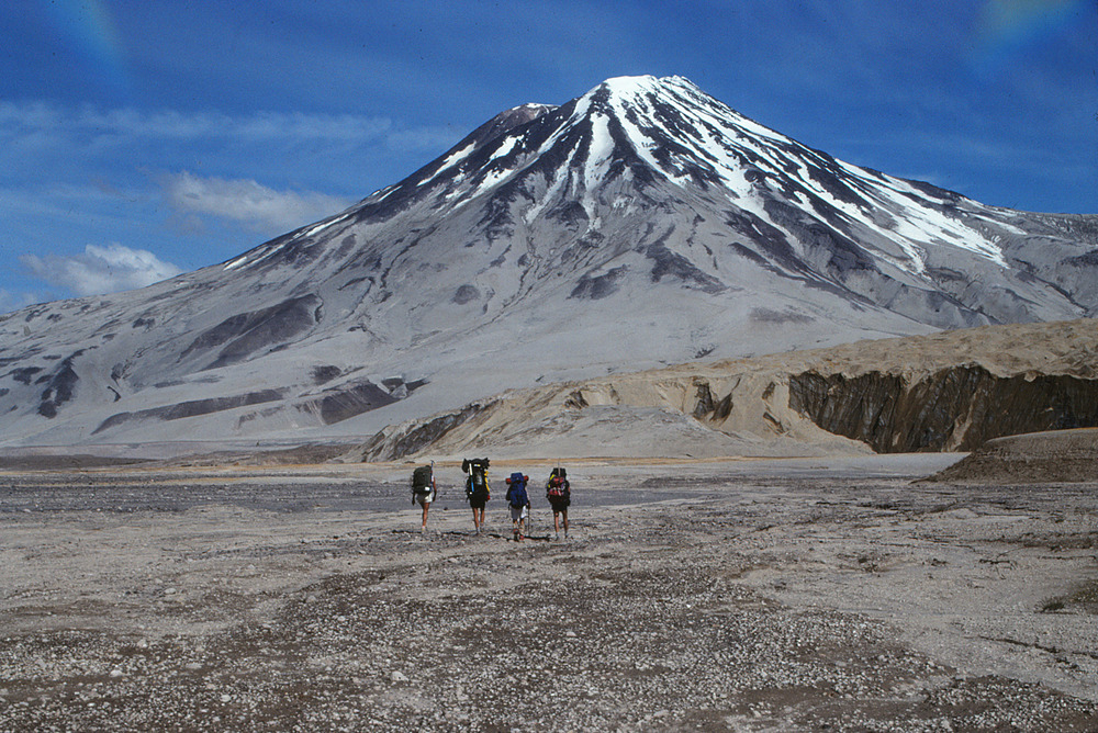
Mount Griggs
Photograph of Mount Griggs, the highest peak in the Katmai cluster.
Photograph of Mount Griggs, the highest
peak in the Katmai cluster. The slopes of the volcano
are coated with ash fall from the 1912 eruption. The
hikers shown in the photograph are walking on the
1912 eruption ignimbrite that fills the Knife Creek
valley. The toe of one of the ash-covered Knife Creek
Glaciers is visible on the right.
Permission must be secured from the individual copyright owners to reproduce any copyrighted materials contained within this website. Digital assets without any copyright restrictions are public domain.
USGS-AVO photograph
by Game McGimsey.
Public domain:Full Granting Rights
Image
Alagnak Wild River, Code: ALAG
Katmai National Park and Preserve, Code: KATM
Katmai National Park and Preserve, Code: KATM
Alagnak Wild River, Lake and Peninsula Borough, Alaska
Latitude: 59.003101348877, Longitude: -156.082000732422
Katmai National Park and Preserve, Alaska
Latitude: 58.5661087036133, Longitude: -154.889404296875
Latitude: 59.003101348877, Longitude: -156.082000732422
Katmai National Park and Preserve, Alaska
Latitude: 58.5661087036133, Longitude: -154.889404296875
07/31/2015
07/31/2015
Public Can View
Friday, September 3, 2021 12:14:37 PM
Friday, September 3, 2021 1:01:58 PM
36_KATM_1358903224.jpg
Friday, July 31, 2015 10:03:19 PM
jpg
2.6 MB
Scenic