Select Item below to DOWNLOAD - Once item is selected, right click and choose 'save as'
e29790ac-11be-4d39-be80-46f7a484e069
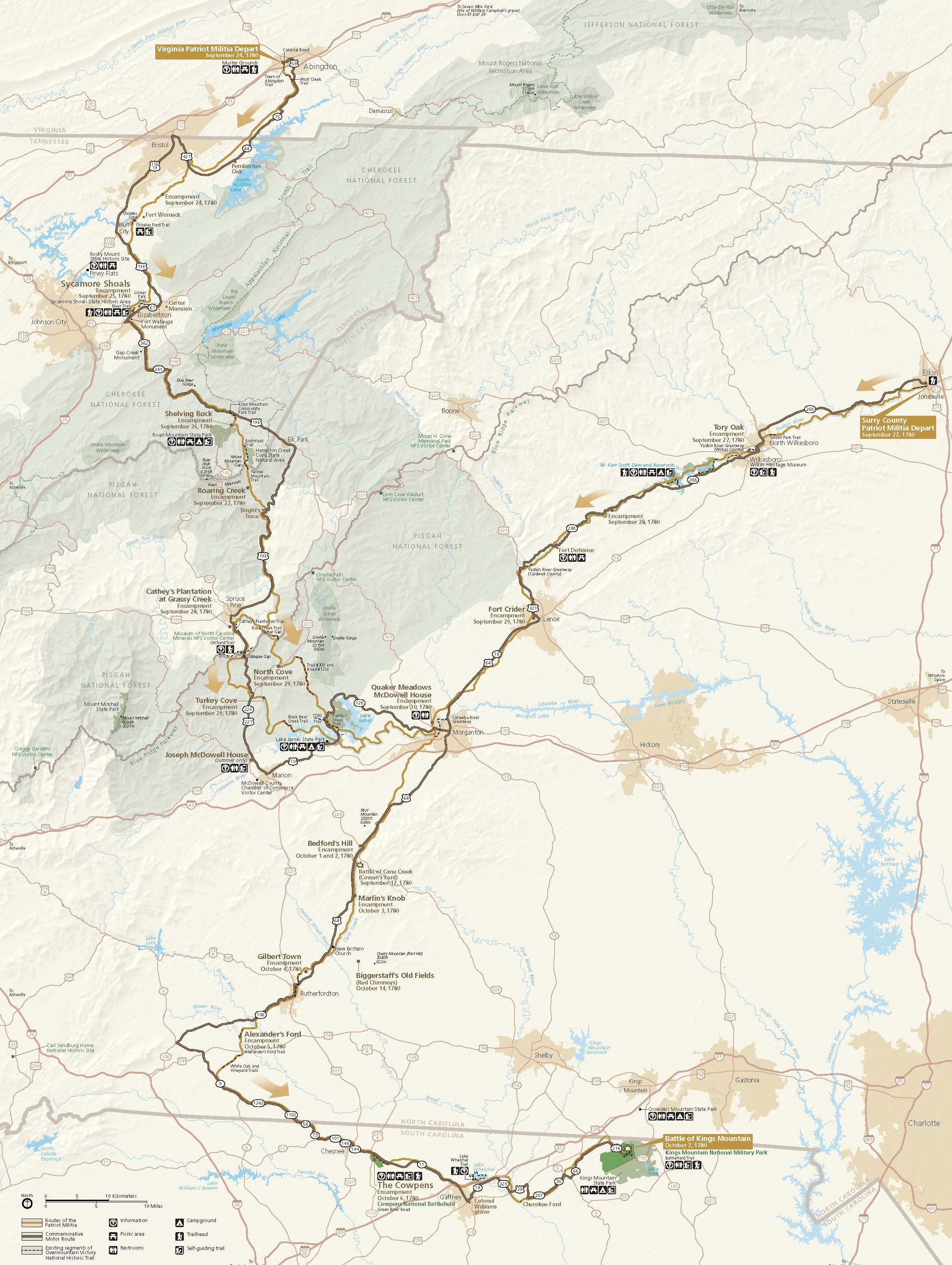
Park Map - Overmountain Victory National Historic Trail
Map of Overmountain Victory National Historic Trail, which begins in Virginia and travels through Tennessee and North Carolina before ending in South Carolina. Two routes across the states are represented in pale or dark brown. Parks are shaded green, and other terrain is beige.
Screen-viewable file; Adobe print production files can be downloaded from the Compressed zip Version link
Map Projection: UTM; Map Type: park map
U.S. National Park Service
The National Park Service maps are government produced and are in the public domain. Anyone may, without restriction under U.S. copyright laws: Reproduce the work in print or digital form; Create derivative works; Perform the work publicly; Display the work; Distribute copies or digitally transfer the work to the public by sale or other transfer of ownership, or by rental, lease, or lending. Please note, a user who modifies and/or republishes National Park Service maps are responsible for any problems encountered with the maps, due to their change or modification.
Public domain
Document
Overmountain Victory National Historic Trail, Code: OVVI
South Carolina ; Tennessee ; Virginia, Overmountain Victory National Historic Trail, North Carolina
Latitude: 35.1669998168945, Longitude: -81.9044036865234
Latitude: 35.1669998168945, Longitude: -81.9044036865234
2022/09/01
Public Can View
Person: Harpers Ferry Center
Organization: US National Park Service
Address: Harpers Ferry Center, Harpers Ferry, WV
Email: HFC_Cartography@nps.gov
Organization: US National Park Service
Address: Harpers Ferry Center, Harpers Ferry, WV
Email: HFC_Cartography@nps.gov
Wednesday, April 27, 2022 9:14:06 PM
Friday, September 26, 2025 11:36:59 PM
OVVImap1.pdf
pdf
10.8 MB
Map