Select Item below to DOWNLOAD - Once item is selected, right click and choose 'save as'
e2202aed-e620-4ea6-a8b4-f8fa30710827
Aleutian Low Map - Glacier Bay National Park and Preserve
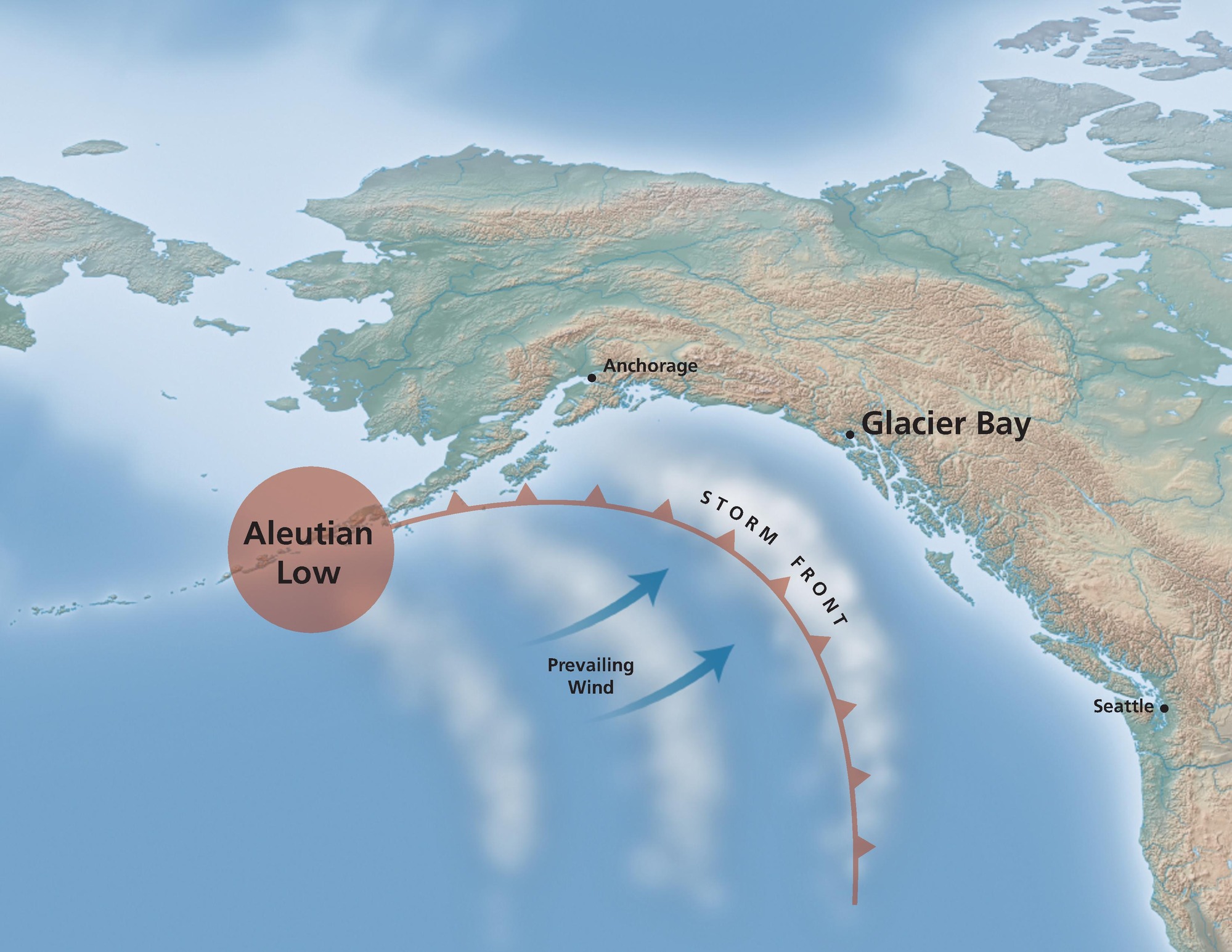
Map of the Aleutian Low low-pressure system along the coast of Glacier Bay National Park and Preserve in Alaska. Shown in frosty green and brown, the state extends from the Pacific Northwest as it arcs across the upper half of the map.
Screen-viewable file; Adobe print production files can be downloaded from the Compressed zip Version link
Map Projection: Other; Map Type: thematic
U.S. National Park Service
The National Park Service maps are government produced and are in the public domain. Anyone may, without restriction under U.S. copyright laws: Reproduce the work in print or digital form; Create derivative works; Perform the work publicly; Display the work; Distribute copies or digitally transfer the work to the public by sale or other transfer of ownership, or by rental, lease, or lending. Please note, a user who modifies and/or republishes National Park Service maps are responsible for any problems encountered with the maps, due to their change or modification.
Public domain
Document
Glacier Bay National Park and Preserve, Code: GLBA
Glacier Bay National Park and Preserve, Alaska
Latitude: 58.700439453125, Longitude: -136.86540222168
Latitude: 58.700439453125, Longitude: -136.86540222168
2018-06-25
Public Can View
Person: Harpers Ferry Center
Organization: US National Park Service
Address: Harpers Ferry Center, Harpers Ferry, WV
Email: HFC_Cartography@nps.gov
Organization: US National Park Service
Address: Harpers Ferry Center, Harpers Ferry, WV
Email: HFC_Cartography@nps.gov
Tuesday, April 26, 2022 8:40:04 PM
Friday, September 26, 2025 11:35:26 PM
GLBAmap6.pdf
pdf
2.4 MB
Map