Select Item below to DOWNLOAD - Once item is selected, right click and choose 'save as'
ddb8a05ff30d4c8495b22216da5f909c
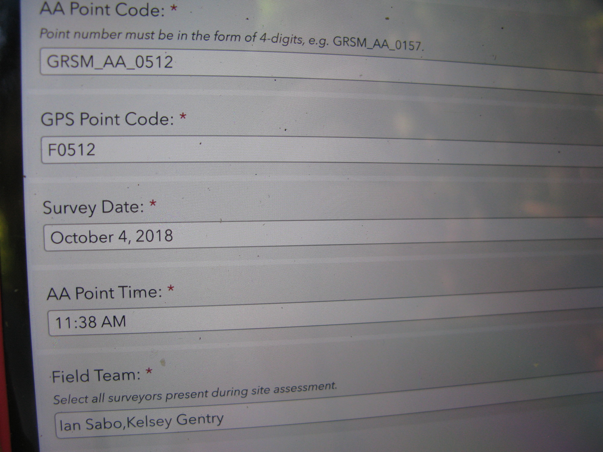
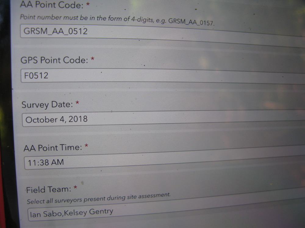
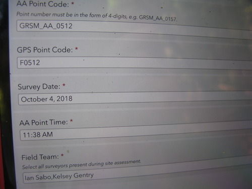
Plot Code: GRSM_AA_0512_1
GRSM Accuracy Assessment. Plot Code: GRSM_AA_0512_1
Plot Code: GRSM_AA_0512_1 from the Great Smoky Mountains National Park (GRSM) Accuracy Assessment.
U.S. National Park Service
Copyright free and in the public domain
Public domain
GRSM_AA_0512, (GRSM PlotCode)
Image
Great Smoky Mountains National Park, Code: GRSM
Great Smoky Mountains National Park
Latitude: 35.5715599060059, Longitude: -83.528190612793
Latitude: 35.5715599060059, Longitude: -83.528190612793
20181004
10/04/2018
Public Can View
Person: Troy Evans
Organization: Great Smoky Mountains NP
Position: Vegetation Ecologist
Address: Gatlinburg, TN 37738
Email: GRSM_iandm@nps.gov.
Organization: Great Smoky Mountains NP
Position: Vegetation Ecologist
Address: Gatlinburg, TN 37738
Email: GRSM_iandm@nps.gov.
Monday, October 22, 2018 9:26:01 AM
Monday, October 22, 2018 9:26:01 AM
GRSM_AA_0512_20181004_1.JPG
jpg
10.8 MB
Monitoring