Select Item below to DOWNLOAD - Once item is selected, right click and choose 'save as'
dd747624-9b2e-402f-b765-afa66c4ef42e
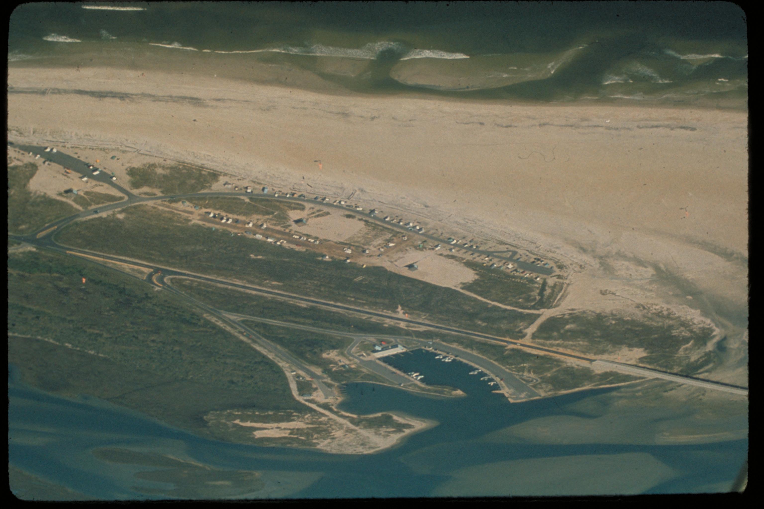
Cape Hatteras National Seashore, North Carolina
Stretched over 70 miles of barrier islands, Cape Hatteras National Seashore is a fascinating combination of natural and cultural resources, and provides a wide variety of recreational opportunities. Once dubbed the "Graveyard of the Atlantic" for its treacherous currents, shoals, and storms, Cape Hatteras has a wealth of history relating to shipwrecks, lighthouses, and the U.S. Lifesaving Service. These dynamic islands provide a variety of habitats and are a valuable wintering area for migrating waterfowl. The park's fishing and surfing are considered the best on the east coast.
Aerial view
National Park Service
Permission must be secured from the individual copyright owners to reproduce any copyrighted materials contained within this website. Digital assets without any copyright restrictions are public domain.
Public domain
Seashores, ()
, Lighthouses, ()
, Lightkeeper houses, ()
, Cranberries (Vaccinioideae), ()
, Capes, ()
, Sunrises and sunsets, ()
, Beaches, ()
, Lighthouses, ()
, Lightkeeper houses, ()
, Cranberries (Vaccinioideae), ()
, Capes, ()
, Sunrises and sunsets, ()
, Beaches, ()
Image
Cape Hatteras National Seashore, Code: CAHA
Cape Hatteras National Seashore, North Carolina
Latitude: 35.2368392944336, Longitude: -75.6029281616211
Latitude: 35.2368392944336, Longitude: -75.6029281616211
Legacy NPS Focus Record ID : 231485
Title: NPS Office of Communications and Public Affairs Photo Library
URL: http://www.nps.gov/pub_aff/imagebase.html
URL: http://www.nps.gov/pub_aff/imagebase.html
01/05/2004
01/01/1980 - 12/30/1999
Public Can View
Wednesday, September 29, 2004 6:26:08 PM
Thursday, August 10, 2017 10:54:16 AM
caha_aerialview_1259.jpg
Monday, January 1, 0001 12:00:00 AM
jpg
473.5 kB
Scenic
Cape Hatteras National Seashore, North Carolina
Cape Hatteras National Seashore, North Carolina
Cape Hatteras National Seashore, North Carolina
Cape Hatteras National Seashore, North Carolina
Cape Hatteras National Seashore, North Carolina
Cape Hatteras National Seashore, North Carolina
Cape Hatteras National Seashore, North Carolina
Cape Hatteras National Seashore, North Carolina