Select Item below to DOWNLOAD - Once item is selected, right click and choose 'save as'
DA736A35-1DD8-B71B-0B85727926F99AB5
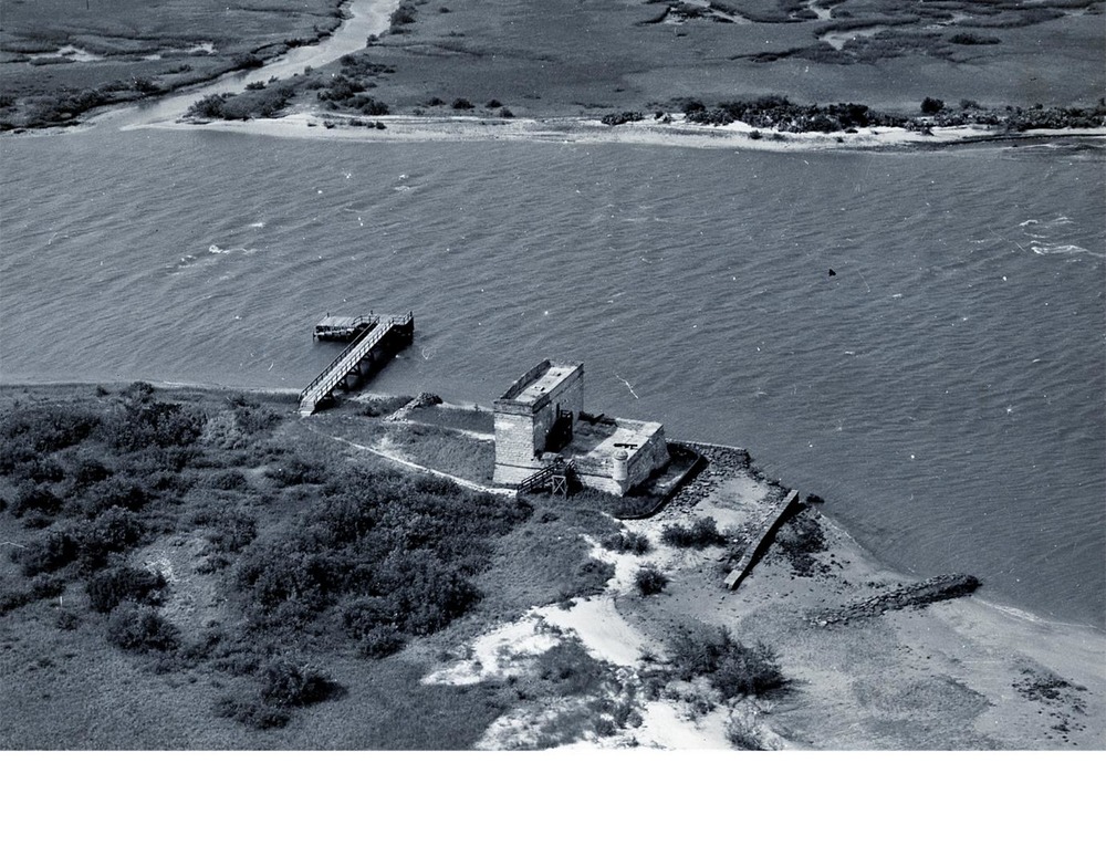
Fort Matanzas in 1947
Fort Matanzas in 1947
Aerial photo of Fort Matanzas in 1947 after building a seawall and jetties to protect the fort from the tidal waters of the Matanzas River. The area in front of the fort was later filled in the 1960s which made it look as we see it today.
U.S. National Park Service
Permission must be secured from the individual copyright owners to reproduce any copyrighted materials contained within this website. Digital assets without any copyright restrictions are public domain.
NPS
Public domain:Full Granting Rights
Image
Fort Matanzas National Monument, Code: FOMA
Fort Matanzas National Monument
Latitude: 29.7152786254883, Longitude: -81.2391662597656
Latitude: 29.7152786254883, Longitude: -81.2391662597656
Public Can View
Monday, January 1, 2018 3:42:16 AM
Monday, January 1, 2018 3:42:16 AM
DA7A13D0-1DD8-B71B-0B5E2EB546AD187F.jpg
Monday, January 1, 0001 12:00:00 AM
jpg
263.5 kB
Scenic