Select Item below to DOWNLOAD - Once item is selected, right click and choose 'save as'
da6cbc09-c359-41d0-bf31-ca4aaeb55fae
THRO_paleontology_inventory_2022_fig 6.jpg
Figure 6.
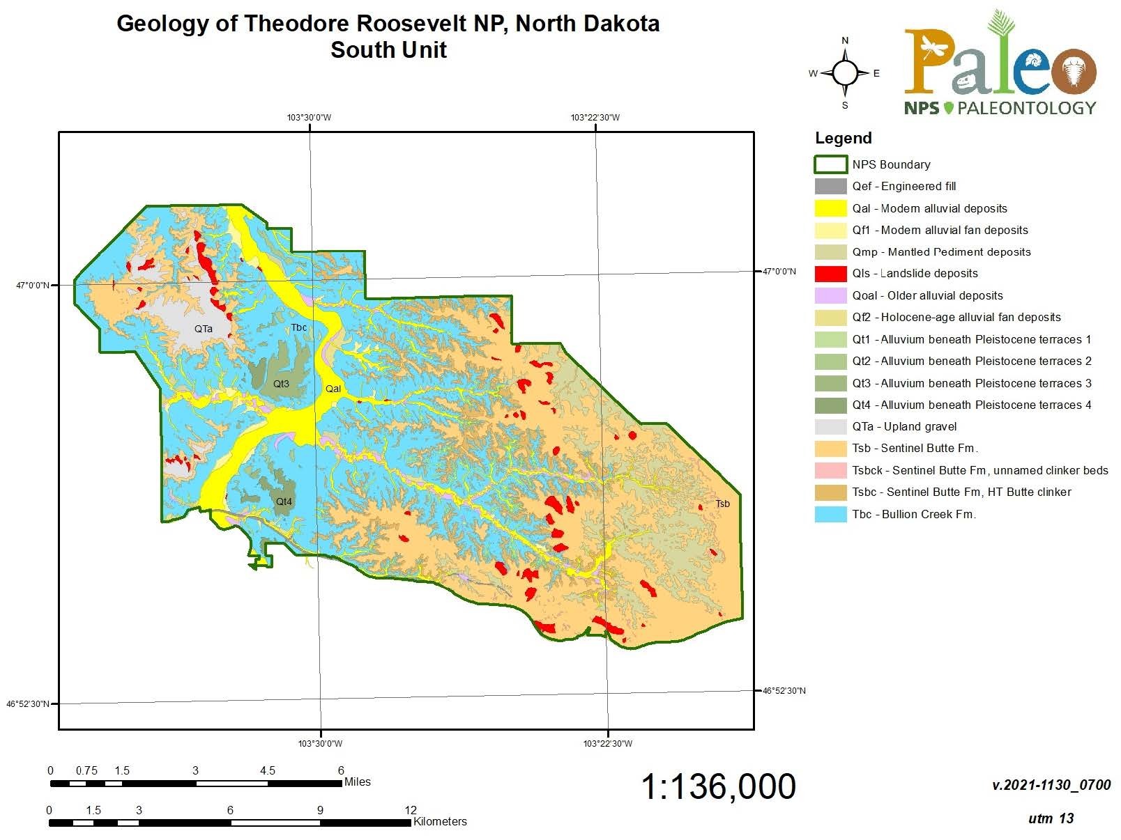
Figure 6. A geologic map of the South Unit of Theodore Roosevelt National Park, using different colors and acronyms to show the locations of various geologic formations.
Figure 6. Geologic map of the South Unit of THRO, derived from Biek and Gonzalez (2001), digitized by the NPS Geologic Resources Inventory (GRI). Digital map data is available at: https://irma.nps.gov/DataStore/Reference/Profile/1044330.
Permission must be secured from the individual copyright owners to reproduce any copyrighted materials contained within this website. Digital assets without any copyright restrictions are public domain.
NPS map.
Public domain:Full Granting Rights
Image
Theodore Roosevelt National Park, Code: THRO
Geologic Resources Division, Code: GRD
Geologic Resources Division, Code: GRD
Theodore Roosevelt National Park, North Dakota
Latitude: 46.9522094726563, Longitude: -103.459701538086
Latitude: 46.9522094726563, Longitude: -103.459701538086
04/25/2024
01/01/0001
Public Can View
Thursday, April 25, 2024 7:17:46 PM
Thursday, April 25, 2024 7:42:32 PM
THRO_paleontology_inventory_2022_fig 6.jpg
Monday, January 1, 0001 12:00:00 AM
jpg
174.5 kB
Scenic