Select Item below to DOWNLOAD - Once item is selected, right click and choose 'save as'
d8b2d13c-9cf3-4d1e-8e81-2a1e8918f146
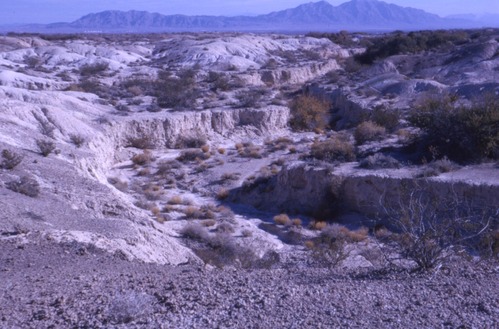
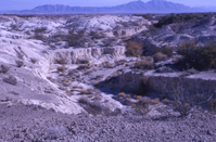
View to south down arroyo below scarp
Image of view looking south down an arroyo below steep slope
Image of view looking south down an arroyo below steep slope as part of the Tule Springs Expedition, also known as the Big Dig.
U. S. National Park Service
Permission must be secured from the individual copyright owners to reproduce any copyrighted materials contained withing this website. Contact Tule Springs Fossil Beds National Monument for more copyright information.
C. Vance Haynes, Jr.
Restrictions apply on use and/or reproduction
Image
Tule Springs Fossil Beds National Monument, Code: TUSK
Clark County, Nevada
Tule Springs Fossil Beds National Monument
Latitude: 36.4290962219238, Longitude: -115.402061462402
Tule Springs Fossil Beds National Monument
Latitude: 36.4290962219238, Longitude: -115.402061462402
1962/10-1963/01
10/01/1962 - 01/30/1963
Photographic Slide
Public Can View
Organization: Tule Springs Fossil Beds National Monument
Address: Tule Springs Fossil Beds National Monument, 601 Nevada Way, Boulder City, NV 89005
Email: tusk_information@nps.gov
Address: Tule Springs Fossil Beds National Monument, 601 Nevada Way, Boulder City, NV 89005
Email: tusk_information@nps.gov
Thursday, July 25, 2024 8:25:23 PM
Thursday, July 25, 2024 8:25:23 PM
TUSK_Haynes_BigDig_016.tif
tif
4.6 MB
Historic