Select Item below to DOWNLOAD - Once item is selected, right click and choose 'save as'
d8aac433-2044-4dcc-a0ad-26c06010b0a2
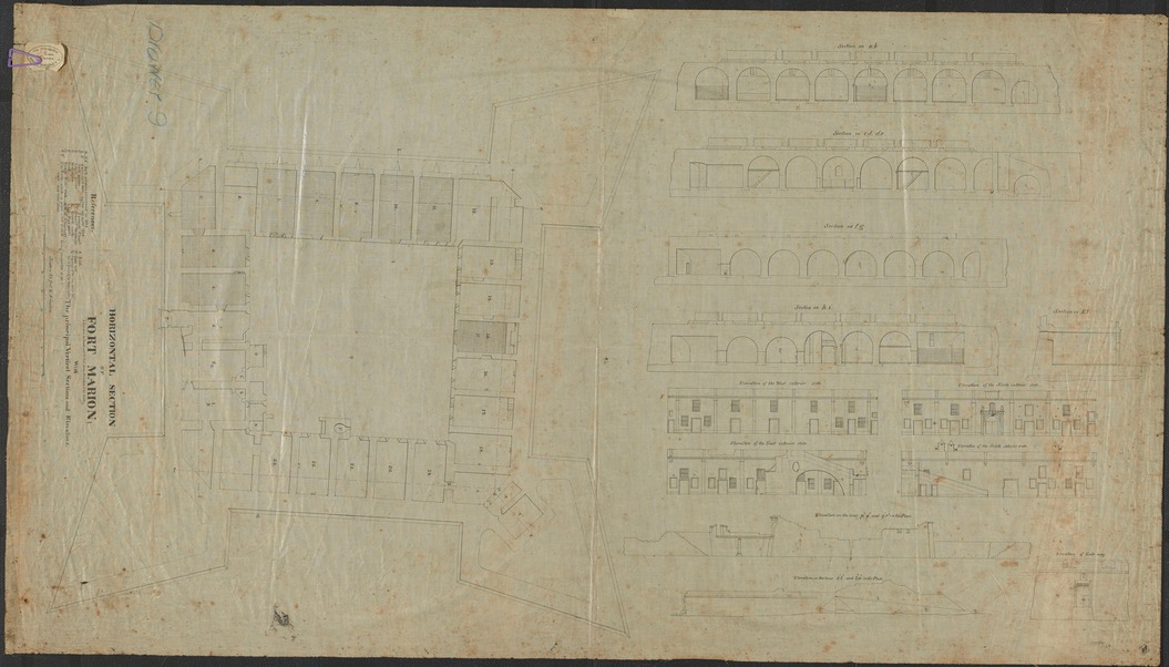
1842 Plan of the Castillo
Black and white drawing of the fortress layout.
The Castillo was re-named Fort Marion by the U.S. Army. This map shows the layout of the rooms and views from the interior courtyard.
Permission must be secured from the individual copyright owners to reproduce any copyrighted materials contained within this website. Digital assets without any copyright restrictions are public domain.
NPS
Public domain:Full Granting Rights
Image
Castillo de San Marcos National Monument, Code: CASA
Castillo de San Marcos National Monument, St. Johns County, Florida
Latitude: 29.8978996276855, Longitude: -81.3122024536133
Latitude: 29.8978996276855, Longitude: -81.3122024536133
1842 Drawing
06/17/2013
Friday, June 19, 2020 5:54:15 AM
Friday, June 19, 2020 5:54:15 AM
1842 map.jpg
Phase One Phase One, IQ180
1/4 sec
ISO 35
Monday, June 17, 2013 9:40:15 PM
jpg
9.5 MB
Scenic