Select Item below to DOWNLOAD - Once item is selected, right click and choose 'save as'
d65acb21-76a5-4775-ac2b-9e174a7673c8
HabitatSuitabilityMapLegend_delete.png
A map of Great Smoky Mountain National Park is shown in green. The only part of the map that shows is the shape of the park, which is shaped a bit like a bean, with the long side of the bean to the bottom of the graphic. Various variables are displayed on top of the map.
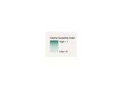
The legend to the habitat suitability map of Great Smoky Mountains National Park.
Permission must be secured from the individual copyright owners to reproduce any copyrighted materials contained within this website. Digital assets without any copyright restrictions are public domain.
Kathryn Nuessly
Public domain:Minimum Granting Rights
Image
Great Smoky Mountains National Park, Code: GRSM
Great Smoky Mountains National Park
Latitude: 35.5715599060059, Longitude: -83.528190612793
Latitude: 35.5715599060059, Longitude: -83.528190612793
Public Can View
Friday, July 2, 2021 2:27:19 PM
Friday, July 2, 2021 2:27:19 PM
HSM Legend.png
png
89.5 kB
Scenic