Select Item below to DOWNLOAD - Once item is selected, right click and choose 'save as'
d60fa046-2e87-4bab-a44e-8e7623c4f290
Washington's Revolutionary Campaign War Map Edited
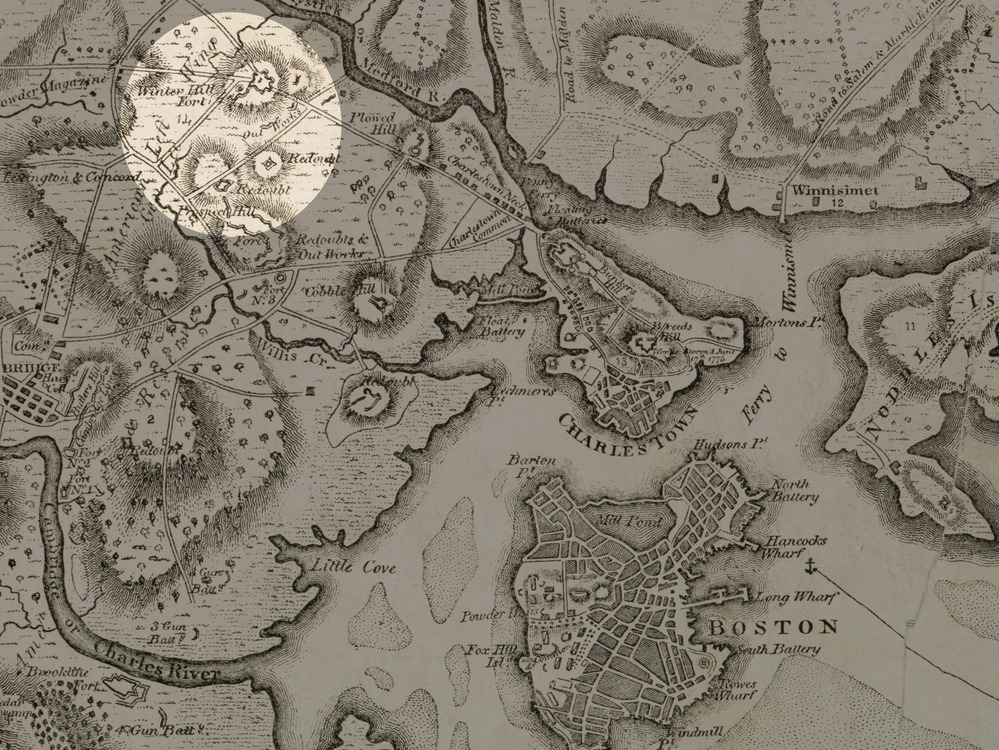
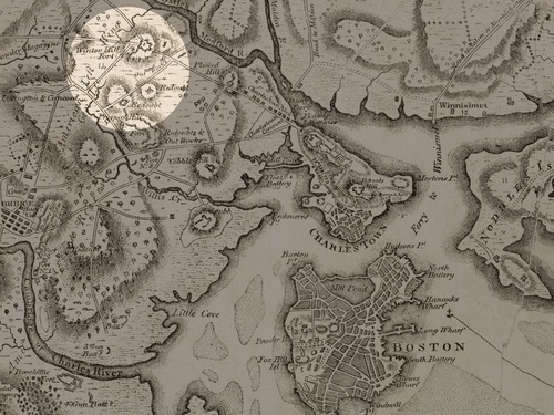
Black and white map of Boston and Charleston, with circle highlighted area around Winter Hill Fort.
General Washington's Revolutionary War campaign war map showing the position of his army in defence of Boston in 1776. This edited version highlights the forts in Winter Hill (present day Somerville).
Boston, Mass : A.O. Crane
This image is used for the Primus Hall (Patriot of Color) story map.
Digital Commonwealth states there are no known restrictions. See this url for more information: https://www.digitalcommonwealth.org/search/commonwealth:wd3768027
Public domain:Digital Commonwealth states there are no known restrictions.
Image
Boston National Historical Park, Code: BOST
Boston National Historical Park, Suffolk County, Massachusetts
Latitude: 42.3734016418457, Longitude: -71.0557022094727
Latitude: 42.3734016418457, Longitude: -71.0557022094727
https://www.digitalcommonwealth.org/search/commonwealth:wd3768027
04/26/2022 | 1875
04/26/2022
Organization: Norman B. Leventhal Map Center/Digital Commonwealth
Friday, April 29, 2022 4:23:06 PM
Friday, April 29, 2022 4:29:54 PM
Winter Hill fort.jpg
Tuesday, April 26, 2022 2:46:12 PM
jpg
2.3 MB
Historic