Select Item below to DOWNLOAD - Once item is selected, right click and choose 'save as'
d3893ec2-ed25-4be0-aefd-6ef23863ae2c
Douglas River
Photograph of marine terraces, sea cliffs, and sea caves raised above the modern high tide level.
. Photograph of marine terraces, sea cliffs, and sea caves raised above the modern high tide level. This island
near the mouth of the Douglas River in Kachemak Bay is a raised marine terrace about 15 m (50 ft) above the modern
high tide level. The cliffs and sea caves have vegetation below them indicating that they are also raised above the high
tide level.
Permission must be secured from the individual copyright owners to reproduce any copyrighted materials contained within this website. Digital assets without any copyright restrictions are public domain.
NPS photograph by Sara Venator
Public domain:Full Granting Rights
Image
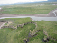
Alagnak Wild River, Code: ALAG
Katmai National Park and Preserve, Code: KATM
Katmai National Park and Preserve, Code: KATM
Alagnak Wild River, Lake and Peninsula Borough, Alaska
Latitude: 59.003101348877, Longitude: -156.082000732422
Katmai National Park and Preserve, Alaska
Latitude: 58.5661087036133, Longitude: -154.889404296875
Latitude: 59.003101348877, Longitude: -156.082000732422
Katmai National Park and Preserve, Alaska
Latitude: 58.5661087036133, Longitude: -154.889404296875
06/06/2016
06/06/2016
Public Can View
Thursday, September 2, 2021 12:52:27 PM
Thursday, September 2, 2021 2:56:03 PM
80_KATM_IMG_0111.JPG
Canon Canon, Canon PowerShot D30
1/160 sec at f / 3.9
5 mm
ISO 200
Monday, June 6, 2016 3:16:05 PM
jpg
3.1 MB
Scenic