Select Item below to DOWNLOAD - Once item is selected, right click and choose 'save as'
d3890cab-5c7b-4b1f-ad7b-79b4af26badf
Hurricane Irene Damage to Bushkill Meeting Center in August 2011
Hurricane Irene Damage to Bushkill Meeting Center parking area in august 2011
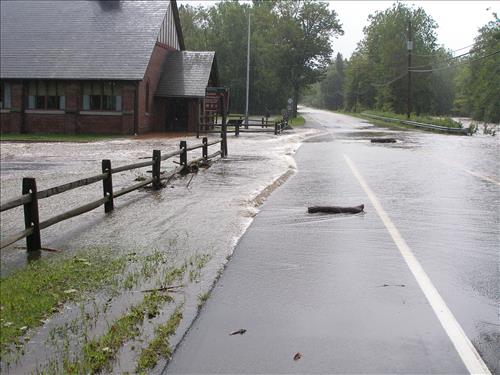
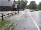
Flood water covering Route 209 and the parking area of Bushkill Meeting Center
Permission must be secured from the individual copyright owners to reproduce any copyrighted materials contained within this website. Digital assets without any copyright restrictions are public domain.
Public domain
Image
Delaware Water Gap National Recreation Area, Code: DEWA
Delaware Water Gap National Recreation Area
Latitude: 41.1003189086914, Longitude: -74.9569320678711
Latitude: 41.1003189086914, Longitude: -74.9569320678711
08/28/2011
09/02/2011
Public Can View
Friday, October 28, 2011 11:56:23 AM
Thursday, August 10, 2017 10:00:00 AM
DEWA-4ea2140f667b4b329e0b7043c8959651.jpg
OLYMPUS IMAGING CORP. OLYMPUS IMAGING CORP., SP320
10/4000 sec at f / 4.5
9.3 mm
ISO 64
Sunday, August 28, 2011 7:32:19 PM
jpg
1.6 MB
Monitoring
,
Budget