Select Item below to DOWNLOAD - Once item is selected, right click and choose 'save as'
d1866575-02f8-4a92-88dc-440769699f6e
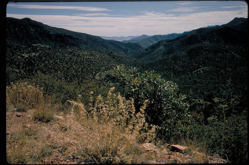
Chiricahua National Monument, Arizona
Twenty seven million years ago a volcanic eruption of immense proportions shook the land around Chiricahua National Monument. One thousand times greater than the 1980 eruption of Mount St. Helens, the Turkey Creek Caldera eruption eventually laid down two thousand feet of highly silicious ash and pumice. This mixture fused into a rock called rhyolitic tuff and eventually eroded into the spires and unusual rock formations of today. The monument is a mecca for hikers and birders.
Desert mountain range
National Park Service
Permission must be secured from the individual copyright owners to reproduce any copyrighted materials contained within this website. Digital assets without any copyright restrictions are public domain.
Public domain
Image
Chiricahua National Monument, Code: CHIR
Chiricahua National Monument, Cochise County, Arizona
Latitude: 32.0121994018555, Longitude: -109.341003417969
Latitude: 32.0121994018555, Longitude: -109.341003417969
Legacy NPS Focus Record ID : 231492
Title: NPS Office of Communications and Public Affairs Photo Library
URL: http://www.nps.gov/pub_aff/imagebase.html
URL: http://www.nps.gov/pub_aff/imagebase.html
01/05/2004
01/01/1980 - 12/30/1999
Wednesday, September 29, 2004 6:26:09 PM
Thursday, August 10, 2017 9:47:35 AM
chir_mountainview_1169.jpg
Monday, January 1, 0001 12:00:00 AM
jpg
929.5 kB
Scenic